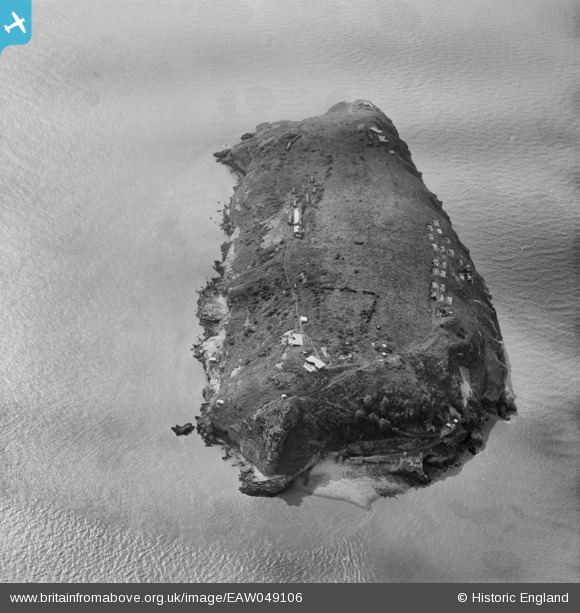
EAW049106 ENGLAND (1953). Steep Holm island, Steep Holm, 1953
© Copyright OpenStreetMap contributors and licensed by the OpenStreetMap Foundation. 2025. Cartography is licensed as CC BY-SA.
Nearby Images (5)
Details
| Title | [EAW049106] Steep Holm island, Steep Holm, 1953 |
| Reference | EAW049106 |
| Date | 6-May-1953 |
| Link | |
| Place name | STEEP HOLM |
| Parish | WESTON-SUPER-MARE |
| District | |
| Country | ENGLAND |
| Easting / Northing | 323034, 160615 |
| Longitude / Latitude | -3.1050466175758, 51.338905082923 |
| National Grid Reference | ST230606 |
Pins
 Teeceee |
Sunday 21st of January 2024 08:56:30 PM | |
 Gen_Hancock |
Friday 3rd of February 2017 12:06:09 PM | |
 jrussill |
Monday 24th of November 2014 11:04:12 PM | |
 jrussill |
Monday 24th of November 2014 11:03:18 PM | |
 jrussill |
Monday 24th of November 2014 11:02:35 PM | |
 Louis |
Wednesday 15th of October 2014 08:09:05 PM |
User Comment Contributions
 jrussill |
Monday 24th of November 2014 11:05:15 PM |


![[EAW049106] Steep Holm island, Steep Holm, 1953](http://britainfromabove.org.uk/sites/all/libraries/aerofilms-images/public/100x100/EAW/049/EAW049106.jpg)
![[EAW049750] Steep Holm island, Steep Holm, 1953](http://britainfromabove.org.uk/sites/all/libraries/aerofilms-images/public/100x100/EAW/049/EAW049750.jpg)
![[EAW049107] Steep Holm island, Steep Holm, 1953](http://britainfromabove.org.uk/sites/all/libraries/aerofilms-images/public/100x100/EAW/049/EAW049107.jpg)
![[EAW049749] Steep Holm island, Steep Holm, 1953](http://britainfromabove.org.uk/sites/all/libraries/aerofilms-images/public/100x100/EAW/049/EAW049749.jpg)
![[EAW049109] Steep Holm island, Steep Holm, 1953. This image has been produced from a damaged negative.](http://britainfromabove.org.uk/sites/all/libraries/aerofilms-images/public/100x100/EAW/049/EAW049109.jpg)
