
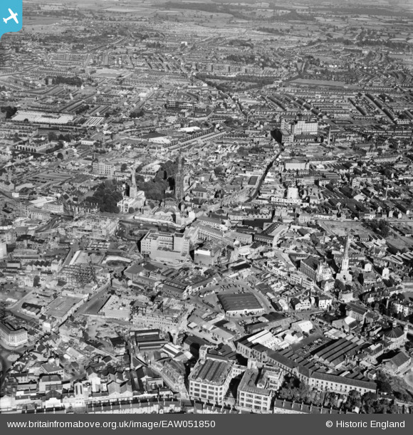
EAW051850 ENGLAND (1953). Broadgate and the city centre, Coventry, 1953
© Copyright OpenStreetMap contributors and licensed by the OpenStreetMap Foundation. 2025. Cartography is licensed as CC BY-SA.
Nearby Images (27)
EAW051850

EAW001831

EAW051849

EAW024985

EAW051848

EPW001190

EAW001829

EAW024984

EAW031598

EAW024986

EAW001835

EAW024987

EAW001830

EAW030282

EAW051852

EAW051846

EAW051853

EAW024988

EAW030281

EAW001833

EAW051845

EPW061111

EAW030280

EPW012041

EAW001834

EAW001832

EAW051851

Details
| Title | [EAW051850] Broadgate and the city centre, Coventry, 1953 |
| Reference | EAW051850 |
| Date | 1-September-1953 |
| Link | |
| Place name | COVENTRY |
| Parish | |
| District | |
| Country | ENGLAND |
| Easting / Northing | 433496, 278939 |
| Longitude / Latitude | -1.5075521101614, 52.407052884975 |
| National Grid Reference | SP335789 |
Pins
 RayG |
Sunday 5th of February 2023 11:32:22 PM | |
RayG |
Sunday 5th of February 2023 11:15:52 PM | |
RayG |
Sunday 5th of February 2023 10:49:10 PM | |
RayG |
Monday 15th of March 2021 11:05:32 PM | |
RayG |
Saturday 14th of November 2020 01:27:05 PM | |
RayG |
Saturday 14th of November 2020 01:09:32 PM | |
John |
Monday 6th of May 2019 02:10:12 PM | |
JG |
Thursday 30th of October 2014 11:51:42 AM | |
JG |
Thursday 30th of October 2014 11:49:47 AM | |
JG |
Thursday 30th of October 2014 11:47:31 AM |