
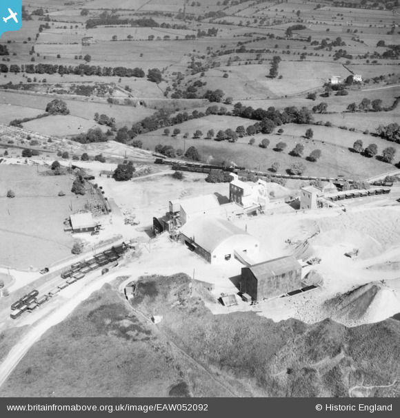
EAW052092 ENGLAND (1953). The Caldonlow Quarries, Cauldon, 1953
© Copyright OpenStreetMap contributors and licensed by the OpenStreetMap Foundation. 2025. Cartography is licensed as CC BY-SA.
Nearby Images (9)
EAW052092

EAW052091

EAW052095

EAW052090

EAW052094

EAW052100

EAW052101

EAW052097

EAW052084

Details
| Title | [EAW052092] The Caldonlow Quarries, Cauldon, 1953 |
| Reference | EAW052092 |
| Date | 7-September-1953 |
| Link | |
| Place name | CAULDON |
| Parish | WATERHOUSES |
| District | |
| Country | ENGLAND |
| Easting / Northing | 407399, 349018 |
| Longitude / Latitude | -1.8896410200947, 53.038082136721 |
| National Grid Reference | SK074490 |
Pins
 bescotbeast |
Wednesday 29th of January 2025 05:14:25 PM | |
bescotbeast |
Wednesday 29th of January 2025 05:12:36 PM | |
bescotbeast |
Wednesday 29th of January 2025 05:12:14 PM | |
bescotbeast |
Wednesday 29th of January 2025 05:10:32 PM | |
bescotbeast |
Wednesday 29th of January 2025 05:09:46 PM |