
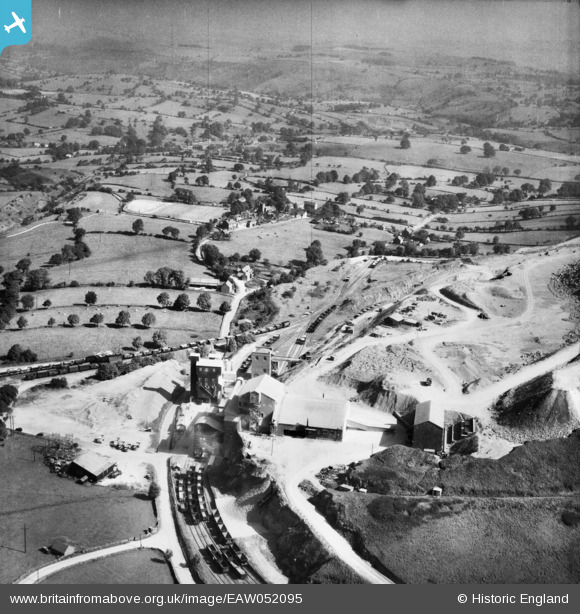
EAW052095 ENGLAND (1953). The Caldonlow Quarries and the village, Cauldon, from the south-west, 1953
© Copyright OpenStreetMap contributors and licensed by the OpenStreetMap Foundation. 2025. Cartography is licensed as CC BY-SA.
Nearby Images (9)
EAW052095

EAW052092

EAW052091

EAW052090

EAW052094

EAW052100

EAW052101

EAW052097

EAW052084

Details
| Title | [EAW052095] The Caldonlow Quarries and the village, Cauldon, from the south-west, 1953 |
| Reference | EAW052095 |
| Date | 7-September-1953 |
| Link | |
| Place name | CAULDON |
| Parish | WATERHOUSES |
| District | |
| Country | ENGLAND |
| Easting / Northing | 407390, 348997 |
| Longitude / Latitude | -1.8897757398192, 53.037893468162 |
| National Grid Reference | SK074490 |
Pins
 bescotbeast |
Thursday 30th of January 2025 03:12:29 PM | |
bescotbeast |
Thursday 30th of January 2025 03:12:00 PM | |
bescotbeast |
Thursday 30th of January 2025 03:11:14 PM |