
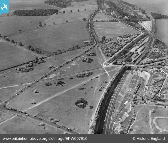
EPW007910 ENGLAND (1922). Banstead Station, Banstead, 1922
© Copyright OpenStreetMap contributors and licensed by the OpenStreetMap Foundation. 2025. Cartography is licensed as CC BY-SA.
Nearby Images (3)
EPW007910

EPW008678

EPW008679

Details
| Title | [EPW007910] Banstead Station, Banstead, 1922 |
| Reference | EPW007910 |
| Date | May-1922 |
| Link | |
| Place name | BANSTEAD |
| Parish | |
| District | |
| Country | ENGLAND |
| Easting / Northing | 524642, 160337 |
| Longitude / Latitude | -0.21082785756638, 51.327951762267 |
| National Grid Reference | TQ246603 |
Pins
 brianbeckett |
Monday 1st of June 2020 04:12:06 PM | |
Banstead100 |
Sunday 24th of April 2016 01:28:46 AM | |
Banstead100 |
Friday 22nd of April 2016 08:56:11 PM | |
Banstead100 |
Friday 22nd of April 2016 08:55:08 PM | |
Banstead100 |
Friday 22nd of April 2016 08:53:49 PM | |
Banstead100 |
Friday 22nd of April 2016 08:53:12 PM | |
Tina |
Sunday 9th of March 2014 06:25:37 PM | |
Rob |
Tuesday 5th of November 2013 05:31:20 PM | |
Rob |
Tuesday 5th of November 2013 05:30:24 PM | |
christhewino |
Wednesday 24th of July 2013 10:51:10 PM | |
christhewino |
Wednesday 24th of July 2013 10:50:20 PM | |
christhewino |
Wednesday 24th of July 2013 10:49:31 PM |