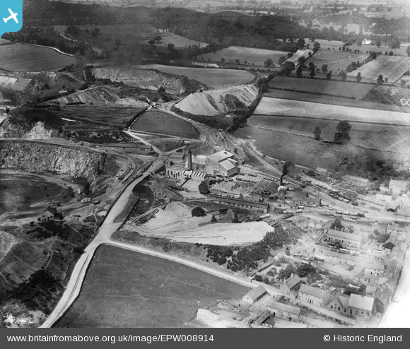
EPW008914 ENGLAND (1923). The quarry buildings at Mountsorrel Quarries, Mountsorrel, 1923
© Copyright OpenStreetMap contributors and licensed by the OpenStreetMap Foundation. 2024. Cartography is licensed as CC BY-SA.
Nearby Images (9)
Details
| Title | [EPW008914] The quarry buildings at Mountsorrel Quarries, Mountsorrel, 1923 |
| Reference | EPW008914 |
| Date | July-1923 |
| Link | |
| Place name | MOUNTSORREL |
| Parish | MOUNTSORREL |
| District | |
| Country | ENGLAND |
| Easting / Northing | 457742, 315145 |
| Longitude / Latitude | -1.1448202410112, 52.730518617638 |
| National Grid Reference | SK577151 |
Pins
Be the first to add a comment to this image!


![[EPW008914] The quarry buildings at Mountsorrel Quarries, Mountsorrel, 1923](http://britainfromabove.org.uk/sites/all/libraries/aerofilms-images/public/100x100/EPW/008/EPW008914.jpg)
![[EPW008918] The quarry buildings at Mountsorrel Quarries, Mountsorrel, 1923](http://britainfromabove.org.uk/sites/all/libraries/aerofilms-images/public/100x100/EPW/008/EPW008918.jpg)
![[EPW008915] The quarry buildings at Mountsorrel Quarries, Mountsorrel, 1923](http://britainfromabove.org.uk/sites/all/libraries/aerofilms-images/public/100x100/EPW/008/EPW008915.jpg)
![[EPW008922] Mountsorrel Quarries, Mountsorrel, from the north-east, 1923](http://britainfromabove.org.uk/sites/all/libraries/aerofilms-images/public/100x100/EPW/008/EPW008922.jpg)
![[EPW008923] Mountsorrel Quarries, Mountsorrel, from the north-east, 1923](http://britainfromabove.org.uk/sites/all/libraries/aerofilms-images/public/100x100/EPW/008/EPW008923.jpg)
![[EPW016808] Mountsorrel Quarries, Mountsorrel, 1926](http://britainfromabove.org.uk/sites/all/libraries/aerofilms-images/public/100x100/EPW/016/EPW016808.jpg)
![[EPW008920] Mountsorrel Quarries, Mountsorrel, from the south-west, 1923](http://britainfromabove.org.uk/sites/all/libraries/aerofilms-images/public/100x100/EPW/008/EPW008920.jpg)
![[EPW008924] Mountsorrel Quarries, Mountsorrel, 1923](http://britainfromabove.org.uk/sites/all/libraries/aerofilms-images/public/100x100/EPW/008/EPW008924.jpg)
![[EPW008919] Mountsorrel Quarries, Mountsorrel, 1923](http://britainfromabove.org.uk/sites/all/libraries/aerofilms-images/public/100x100/EPW/008/EPW008919.jpg)