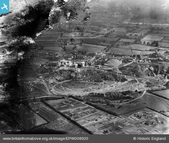
EPW008920 ENGLAND (1923). Mountsorrel Quarries, Mountsorrel, from the south-west, 1923
© Copyright OpenStreetMap contributors and licensed by the OpenStreetMap Foundation. 2024. Cartography is licensed as CC BY-SA.
Nearby Images (11)
Details
| Title | [EPW008920] Mountsorrel Quarries, Mountsorrel, from the south-west, 1923 |
| Reference | EPW008920 |
| Date | July-1923 |
| Link | |
| Place name | MOUNTSORREL |
| Parish | MOUNTSORREL |
| District | |
| Country | ENGLAND |
| Easting / Northing | 457708, 314969 |
| Longitude / Latitude | -1.1453546720432, 52.728940072987 |
| National Grid Reference | SK577150 |
Pins
 Keith |
Thursday 24th of July 2014 01:04:01 PM |


![[EPW008920] Mountsorrel Quarries, Mountsorrel, from the south-west, 1923](http://britainfromabove.org.uk/sites/all/libraries/aerofilms-images/public/100x100/EPW/008/EPW008920.jpg)
![[EPW008919] Mountsorrel Quarries, Mountsorrel, 1923](http://britainfromabove.org.uk/sites/all/libraries/aerofilms-images/public/100x100/EPW/008/EPW008919.jpg)
![[EPW008922] Mountsorrel Quarries, Mountsorrel, from the north-east, 1923](http://britainfromabove.org.uk/sites/all/libraries/aerofilms-images/public/100x100/EPW/008/EPW008922.jpg)
![[EPW008924] Mountsorrel Quarries, Mountsorrel, 1923](http://britainfromabove.org.uk/sites/all/libraries/aerofilms-images/public/100x100/EPW/008/EPW008924.jpg)
![[EPW008917] Mountsorrel Quarries, Mountsorrel, 1923](http://britainfromabove.org.uk/sites/all/libraries/aerofilms-images/public/100x100/EPW/008/EPW008917.jpg)
![[EPW016808] Mountsorrel Quarries, Mountsorrel, 1926](http://britainfromabove.org.uk/sites/all/libraries/aerofilms-images/public/100x100/EPW/016/EPW016808.jpg)
![[EPW008915] The quarry buildings at Mountsorrel Quarries, Mountsorrel, 1923](http://britainfromabove.org.uk/sites/all/libraries/aerofilms-images/public/100x100/EPW/008/EPW008915.jpg)
![[EPW008923] Mountsorrel Quarries, Mountsorrel, from the north-east, 1923](http://britainfromabove.org.uk/sites/all/libraries/aerofilms-images/public/100x100/EPW/008/EPW008923.jpg)
![[EPW008914] The quarry buildings at Mountsorrel Quarries, Mountsorrel, 1923](http://britainfromabove.org.uk/sites/all/libraries/aerofilms-images/public/100x100/EPW/008/EPW008914.jpg)
![[EPW008916] Mountsorrel Quarries, Mountsorrel, 1923](http://britainfromabove.org.uk/sites/all/libraries/aerofilms-images/public/100x100/EPW/008/EPW008916.jpg)
![[EPW008918] The quarry buildings at Mountsorrel Quarries, Mountsorrel, 1923](http://britainfromabove.org.uk/sites/all/libraries/aerofilms-images/public/100x100/EPW/008/EPW008918.jpg)