
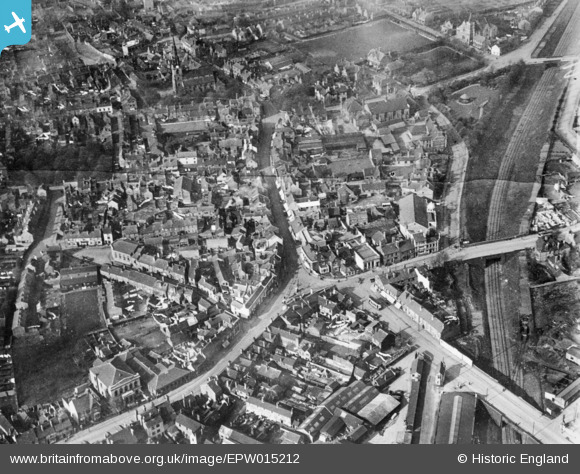
EPW015212 ENGLAND (1926). The town centre, Darlaston, 1926. This image has been produced from a copy-negative.
© Copyright OpenStreetMap contributors and licensed by the OpenStreetMap Foundation. 2024. Cartography is licensed as CC BY-SA.
Nearby Images (4)
EPW015212

EAW031423

EAW031424

EAW031425

Details
| Title | [EPW015212] The town centre, Darlaston, 1926. This image has been produced from a copy-negative. |
| Reference | EPW015212 |
| Date | 13-April-1926 |
| Link | |
| Place name | DARLASTON |
| Parish | |
| District | |
| Country | ENGLAND |
| Easting / Northing | 397715, 296606 |
| Longitude / Latitude | -2.0337152751628, 52.566917535671 |
| National Grid Reference | SO977966 |
Pins
 waynesiverns |
Wednesday 16th of October 2024 01:40:33 PM | |
waynesiverns |
Wednesday 16th of October 2024 01:38:55 PM | |
waynesiverns |
Wednesday 16th of October 2024 01:37:20 PM | |
waynesiverns |
Wednesday 16th of October 2024 01:36:15 PM | |
waynesiverns |
Wednesday 16th of October 2024 01:34:38 PM | |
waynesiverns |
Wednesday 16th of October 2024 01:32:36 PM | |
waynesiverns |
Wednesday 16th of October 2024 01:29:33 PM | |
waynesiverns |
Wednesday 16th of October 2024 01:26:28 PM | |
darloman |
Monday 17th of August 2020 01:41:27 PM | |
KevTheBusDriver |
Sunday 28th of June 2015 09:32:18 PM | |
KevTheBusDriver |
Sunday 28th of June 2015 09:31:42 PM |