
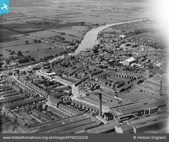
EPW016158 ENGLAND (1926). The town centre, Gainsborough, from the south-east, 1926
© Copyright OpenStreetMap contributors and licensed by the OpenStreetMap Foundation. 2025. Cartography is licensed as CC BY-SA.
Nearby Images (20)
EPW016158

EPW062186

EAW015692

EPW062185

EPW062187

EPW062190

EAW015693

EAW015695

EAW015694

EAW015690

EAW015688

EAW015691

EPW062191

EAW015687

EPW062210

EPW016162

EPW062206

EPW016157

EPW016160

EAW015689

Details
| Title | [EPW016158] The town centre, Gainsborough, from the south-east, 1926 |
| Reference | EPW016158 |
| Date | 2-July-1926 |
| Link | |
| Place name | GAINSBOROUGH |
| Parish | GAINSBOROUGH |
| District | |
| Country | ENGLAND |
| Easting / Northing | 481714, 389589 |
| Longitude / Latitude | -0.7709595532887, 53.396536659324 |
| National Grid Reference | SK817896 |
Pins
 Paddy Buckley |
Sunday 21st of October 2012 02:01:12 PM | |
Paddy Buckley |
Sunday 21st of October 2012 02:00:18 PM | |
Paddy Buckley |
Sunday 21st of October 2012 01:59:13 PM | |
Paddy Buckley |
Sunday 21st of October 2012 01:56:42 PM | |
Paddy Buckley |
Sunday 21st of October 2012 01:55:36 PM | |
Paddy Buckley |
Sunday 21st of October 2012 01:54:12 PM | |
Paddy Buckley |
Sunday 21st of October 2012 01:18:03 PM | |
Paddy Buckley |
Sunday 21st of October 2012 01:17:33 PM |