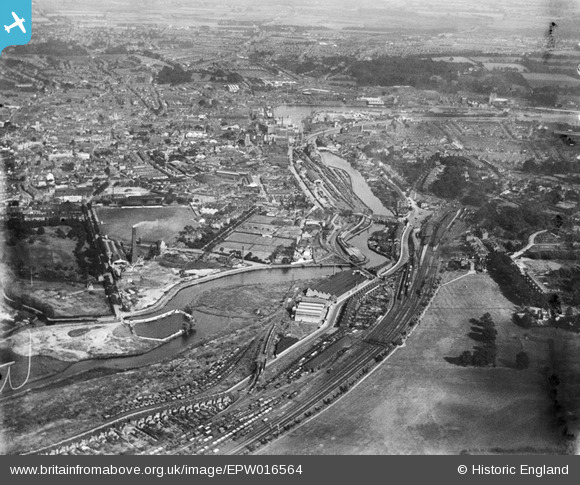
EPW016564 ENGLAND (1926). The River Orwell and the town, Ipswich, from the west, 1926
© Copyright OpenStreetMap contributors and licensed by the OpenStreetMap Foundation. 2025. Cartography is licensed as CC BY-SA.
Details
| Title | [EPW016564] The River Orwell and the town, Ipswich, from the west, 1926 |
| Reference | EPW016564 |
| Date | August-1926 |
| Link | |
| Place name | IPSWICH |
| Parish | |
| District | |
| Country | ENGLAND |
| Easting / Northing | 615185, 244076 |
| Longitude / Latitude | 1.1388750137365, 52.052800089814 |
| National Grid Reference | TM152441 |
Pins
 pf329 |
Wednesday 24th of July 2019 10:06:54 AM | |
 pf329 |
Wednesday 24th of July 2019 10:04:19 AM | |
 John W |
Saturday 21st of January 2017 04:40:03 PM | |
 John W |
Saturday 21st of January 2017 04:39:37 PM | |
 John W |
Saturday 21st of January 2017 04:38:21 PM | |
 Glen37037 |
Wednesday 4th of July 2012 01:38:07 PM | |
 kevin_s |
Wednesday 4th of July 2012 01:28:44 PM |
User Comment Contributions
 kevin_s |
Wednesday 4th of July 2012 01:31:38 PM |


![[EPW016564] The River Orwell and the town, Ipswich, from the west, 1926](http://britainfromabove.org.uk/sites/all/libraries/aerofilms-images/public/100x100/EPW/016/EPW016564.jpg)
![[EAW024673] The western part of the town, Ipswich, from the south, 1949](http://britainfromabove.org.uk/sites/all/libraries/aerofilms-images/public/100x100/EAW/024/EAW024673.jpg)
