
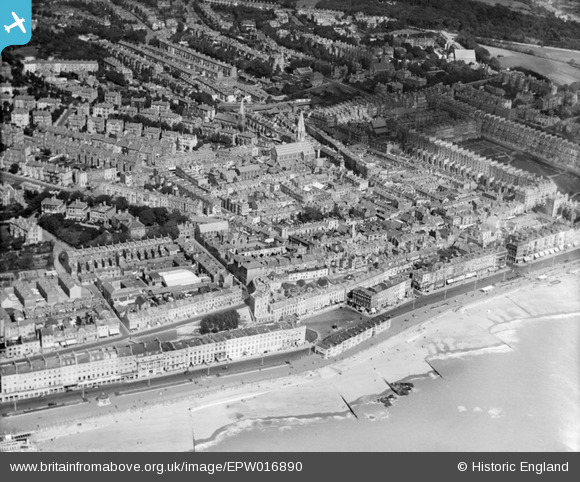
EPW016890 ENGLAND (1926). Christ Church and environs, Hastings, 1926
© Copyright OpenStreetMap contributors and licensed by the OpenStreetMap Foundation. 2025. Cartography is licensed as CC BY-SA.
Nearby Images (8)
EPW016890

EAW002415

EPW000114

EPW035344

EPW000117

EAW002414

EPW026208

EPW042841

Details
| Title | [EPW016890] Christ Church and environs, Hastings, 1926 |
| Reference | EPW016890 |
| Date | August-1926 |
| Link | |
| Place name | HASTINGS |
| Parish | |
| District | |
| Country | ENGLAND |
| Easting / Northing | 580173, 108995 |
| Longitude / Latitude | 0.5599519488049, 50.851811814804 |
| National Grid Reference | TQ802090 |
Pins
 John W |
Thursday 4th of May 2017 06:29:08 PM | |
 Class31 |
Saturday 6th of October 2012 04:32:51 PM | |
Class31 |
Saturday 6th of October 2012 04:31:19 PM | |
Class31 |
Saturday 6th of October 2012 04:30:15 PM | |
Class31 |
Saturday 6th of October 2012 04:29:51 PM | |
Class31 |
Saturday 6th of October 2012 04:28:56 PM | |
Class31 |
Saturday 6th of October 2012 04:28:16 PM | |
Class31 |
Saturday 6th of October 2012 04:27:12 PM | |
Class31 |
Saturday 6th of October 2012 04:25:39 PM | |
Class31 |
Saturday 6th of October 2012 04:24:47 PM | |
Class31 |
Saturday 6th of October 2012 04:24:17 PM | |
Class31 |
Saturday 6th of October 2012 04:21:37 PM | |
Class31 |
Saturday 6th of October 2012 04:19:26 PM |