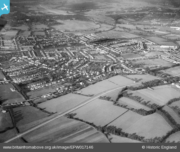
EPW017146 ENGLAND (1926). The town, New Malden, from the south, 1926
© Copyright OpenStreetMap contributors and licensed by the OpenStreetMap Foundation. 2025. Cartography is licensed as CC BY-SA.
Details
| Title | [EPW017146] The town, New Malden, from the south, 1926 |
| Reference | EPW017146 |
| Date | October-1926 |
| Link | |
| Place name | NEW MALDEN |
| Parish | |
| District | |
| Country | ENGLAND |
| Easting / Northing | 521078, 167402 |
| Longitude / Latitude | -0.25955578795051, 51.392226142019 |
| National Grid Reference | TQ211674 |
Pins
 mike |
Thursday 5th of June 2014 10:43:09 PM | |
Now part of the A3 would be more accurate. |
 John Wass |
Sunday 24th of May 2015 04:30:35 PM |
 mike |
Thursday 5th of June 2014 10:42:18 PM | |
 mike |
Thursday 5th of June 2014 10:39:27 PM | |
 mike |
Thursday 5th of June 2014 10:38:23 PM |


![[EPW017146] The town, New Malden, from the south, 1926](http://britainfromabove.org.uk/sites/all/libraries/aerofilms-images/public/100x100/EPW/017/EPW017146.jpg)
![[EPW017336] Bodley Road and environs, New Malden, 1926](http://britainfromabove.org.uk/sites/all/libraries/aerofilms-images/public/100x100/EPW/017/EPW017336.jpg)
![[EPW020677] The Kingston Bypass, Old Malden, 1928](http://britainfromabove.org.uk/sites/all/libraries/aerofilms-images/public/100x100/EPW/020/EPW020677.jpg)
![[EPW017147] The town, New Malden, from the south-west, 1926](http://britainfromabove.org.uk/sites/all/libraries/aerofilms-images/public/100x100/EPW/017/EPW017147.jpg)