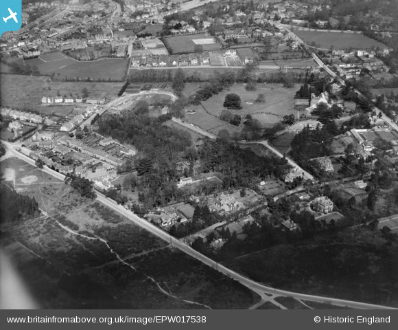
EPW017538 ENGLAND (1927). Weybridge Park and environs, Weybridge, 1927
© Copyright OpenStreetMap contributors and licensed by the OpenStreetMap Foundation. 2025. Cartography is licensed as CC BY-SA.
Nearby Images (10)
Details
| Title | [EPW017538] Weybridge Park and environs, Weybridge, 1927 |
| Reference | EPW017538 |
| Date | 8-April-1927 |
| Link | |
| Place name | WEYBRIDGE |
| Parish | |
| District | |
| Country | ENGLAND |
| Easting / Northing | 507413, 164157 |
| Longitude / Latitude | -0.45688422437189, 51.365807554306 |
| National Grid Reference | TQ074642 |
Pins
Be the first to add a comment to this image!


![[EPW017538] Weybridge Park and environs, Weybridge, 1927](http://britainfromabove.org.uk/sites/all/libraries/aerofilms-images/public/100x100/EPW/017/EPW017538.jpg)
![[EPW017547] Weybridge Park, Weybridge, 1927](http://britainfromabove.org.uk/sites/all/libraries/aerofilms-images/public/100x100/EPW/017/EPW017547.jpg)
![[EPW017548] Weybridge Park, Weybridge, 1927](http://britainfromabove.org.uk/sites/all/libraries/aerofilms-images/public/100x100/EPW/017/EPW017548.jpg)
![[EPW017546] Mansfield Close and environs, Weybridge, 1927](http://britainfromabove.org.uk/sites/all/libraries/aerofilms-images/public/100x100/EPW/017/EPW017546.jpg)
![[EPW017545] The Heath and Oatlands Park, Weybridge, from the west, 1927](http://britainfromabove.org.uk/sites/all/libraries/aerofilms-images/public/100x100/EPW/017/EPW017545.jpg)
![[EPW017540] Weybridge Park and environs, Weybridge, 1927](http://britainfromabove.org.uk/sites/all/libraries/aerofilms-images/public/100x100/EPW/017/EPW017540.jpg)
![[EPW017537] Weybridge Park and environs, Weybridge, 1927](http://britainfromabove.org.uk/sites/all/libraries/aerofilms-images/public/100x100/EPW/017/EPW017537.jpg)
![[EPW028335] Hanger Hill and The Manor, Weybridge, 1929](http://britainfromabove.org.uk/sites/all/libraries/aerofilms-images/public/100x100/EPW/028/EPW028335.jpg)
![[EPW023390] The Manor and Weybridge Park, Weybridge, 1928](http://britainfromabove.org.uk/sites/all/libraries/aerofilms-images/public/100x100/EPW/023/EPW023390.jpg)
![[EPW017541] The Heath, Weybridge, from the north-west, 1927](http://britainfromabove.org.uk/sites/all/libraries/aerofilms-images/public/100x100/EPW/017/EPW017541.jpg)