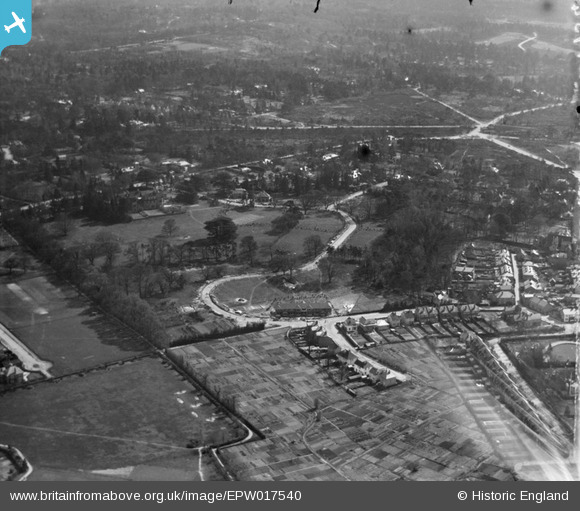
EPW017540 ENGLAND (1927). Weybridge Park and environs, Weybridge, 1927
© Copyright OpenStreetMap contributors and licensed by the OpenStreetMap Foundation. 2025. Cartography is licensed as CC BY-SA.
Nearby Images (10)
Details
| Title | [EPW017540] Weybridge Park and environs, Weybridge, 1927 |
| Reference | EPW017540 |
| Date | 8-April-1927 |
| Link | |
| Place name | WEYBRIDGE |
| Parish | |
| District | |
| Country | ENGLAND |
| Easting / Northing | 507508, 164301 |
| Longitude / Latitude | -0.45547641238598, 51.367084055046 |
| National Grid Reference | TQ075643 |
Pins
 richardj |
Wednesday 8th of March 2017 03:04:07 PM | |
 richardj |
Wednesday 8th of March 2017 03:02:30 PM | |
 richardj |
Wednesday 8th of March 2017 02:59:46 PM | |
 richardj |
Wednesday 8th of March 2017 02:59:10 PM | |
 richardj |
Wednesday 8th of March 2017 02:51:13 PM | |
 richardj |
Wednesday 8th of March 2017 02:49:39 PM | |
 richardj |
Wednesday 8th of March 2017 02:43:01 PM | |
 richardj |
Wednesday 8th of March 2017 02:42:33 PM | |
 richardj |
Wednesday 8th of March 2017 02:39:50 PM | |
 mpg |
Saturday 18th of October 2014 05:43:51 PM |


![[EPW017540] Weybridge Park and environs, Weybridge, 1927](http://britainfromabove.org.uk/sites/all/libraries/aerofilms-images/public/100x100/EPW/017/EPW017540.jpg)
![[EPW017537] Weybridge Park and environs, Weybridge, 1927](http://britainfromabove.org.uk/sites/all/libraries/aerofilms-images/public/100x100/EPW/017/EPW017537.jpg)
![[EPW017547] Weybridge Park, Weybridge, 1927](http://britainfromabove.org.uk/sites/all/libraries/aerofilms-images/public/100x100/EPW/017/EPW017547.jpg)
![[EPW017548] Weybridge Park, Weybridge, 1927](http://britainfromabove.org.uk/sites/all/libraries/aerofilms-images/public/100x100/EPW/017/EPW017548.jpg)
![[EPW023390] The Manor and Weybridge Park, Weybridge, 1928](http://britainfromabove.org.uk/sites/all/libraries/aerofilms-images/public/100x100/EPW/023/EPW023390.jpg)
![[EPW017543] Weybridge Park and environs, Weybridge, 1927](http://britainfromabove.org.uk/sites/all/libraries/aerofilms-images/public/100x100/EPW/017/EPW017543.jpg)
![[EPW017538] Weybridge Park and environs, Weybridge, 1927](http://britainfromabove.org.uk/sites/all/libraries/aerofilms-images/public/100x100/EPW/017/EPW017538.jpg)
![[EPW028335] Hanger Hill and The Manor, Weybridge, 1929](http://britainfromabove.org.uk/sites/all/libraries/aerofilms-images/public/100x100/EPW/028/EPW028335.jpg)
![[EPW017546] Mansfield Close and environs, Weybridge, 1927](http://britainfromabove.org.uk/sites/all/libraries/aerofilms-images/public/100x100/EPW/017/EPW017546.jpg)
![[EPW017545] The Heath and Oatlands Park, Weybridge, from the west, 1927](http://britainfromabove.org.uk/sites/all/libraries/aerofilms-images/public/100x100/EPW/017/EPW017545.jpg)