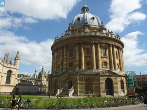
EPW017839 ENGLAND (1927). St Aldate's Street and the city centre, Oxford, 1927
© Copyright OpenStreetMap contributors and licensed by the OpenStreetMap Foundation. 2025. Cartography is licensed as CC BY-SA.
Nearby Images (29)
Details
| Title | [EPW017839] St Aldate's Street and the city centre, Oxford, 1927 |
| Reference | EPW017839 |
| Date | April-1927 |
| Link | |
| Place name | OXFORD |
| Parish | |
| District | |
| Country | ENGLAND |
| Easting / Northing | 451430, 205947 |
| Longitude / Latitude | -1.2549199202245, 51.749400727307 |
| National Grid Reference | SP514059 |
Pins
 peter stuart legat |
Saturday 13th of June 2020 06:53:43 PM | |
 Alan McFaden |
Saturday 8th of November 2014 10:59:53 AM | |
 Piper7 |
Friday 26th of April 2013 11:49:47 AM |
User Comment Contributions
 Oxford Bridge of Sighs |
 Alan McFaden |
Saturday 8th of November 2014 11:02:47 AM |
 Saint Giles Church Oxford |
 Alan McFaden |
Saturday 8th of November 2014 11:02:21 AM |
 Oxford Pittrivers Museum |
 Alan McFaden |
Saturday 8th of November 2014 11:01:49 AM |
 Oxford Pittrivers Museum |
 Alan McFaden |
Saturday 8th of November 2014 11:01:22 AM |
 Christ Church Oxford |
 Alan McFaden |
Saturday 8th of November 2014 11:00:56 AM |
 Saint Mary's Church Oxford |
 Alan McFaden |
Saturday 8th of November 2014 11:00:24 AM |


![[EPW017839] St Aldate's Street and the city centre, Oxford, 1927](http://britainfromabove.org.uk/sites/all/libraries/aerofilms-images/public/100x100/EPW/017/EPW017839.jpg)
![[EPW000843] Christ Church area of Oxford, Oxford, 1920](http://britainfromabove.org.uk/sites/all/libraries/aerofilms-images/public/100x100/EPW/000/EPW000843.jpg)
![[EPW052774] The University Colleges and the city centre, Oxford, from the south-west, 1937](http://britainfromabove.org.uk/sites/all/libraries/aerofilms-images/public/100x100/EPW/052/EPW052774.jpg)
![[EAW047925] The city in the snow, Oxford, from the south, 1952](http://britainfromabove.org.uk/sites/all/libraries/aerofilms-images/public/100x100/EAW/047/EAW047925.jpg)
![[EPW000829] General view over Oxford showing Christ Church and Radcliffe Camera, Oxford, from the south-west, 1920](http://britainfromabove.org.uk/sites/all/libraries/aerofilms-images/public/100x100/EPW/000/EPW000829.jpg)
![[EPW024627] Christ Church and Oxford Cathedral, Oxford, 1928](http://britainfromabove.org.uk/sites/all/libraries/aerofilms-images/public/100x100/EPW/024/EPW024627.jpg)
![[EAW003127] The city, Oxford, from the south, 1946](http://britainfromabove.org.uk/sites/all/libraries/aerofilms-images/public/100x100/EAW/003/EAW003127.jpg)
![[EPW000832] Christ Church, Oxford, 1920](http://britainfromabove.org.uk/sites/all/libraries/aerofilms-images/public/100x100/EPW/000/EPW000832.jpg)
![[EAW045713] Christchurch, Oxford, 1952. This image has been produced from a print.](http://britainfromabove.org.uk/sites/all/libraries/aerofilms-images/public/100x100/EAW/045/EAW045713.jpg)
![[EPW038408] Christ Church and the city centre, Oxford, 1932](http://britainfromabove.org.uk/sites/all/libraries/aerofilms-images/public/100x100/EPW/038/EPW038408.jpg)
![[EPW022530] Christ Church and the city, Oxford, 1928](http://britainfromabove.org.uk/sites/all/libraries/aerofilms-images/public/100x100/EPW/022/EPW022530.jpg)
![[EAW014893] The city, Oxford, from the south-east, 1948. This image has been produced from a print.](http://britainfromabove.org.uk/sites/all/libraries/aerofilms-images/public/100x100/EAW/014/EAW014893.jpg)
![[EAW049085] High Street and the city centre, Oxford, 1953](http://britainfromabove.org.uk/sites/all/libraries/aerofilms-images/public/100x100/EAW/049/EAW049085.jpg)
![[EAW045705] St Aldate's and environs, Oxford, 1952. This image has been produced from a print.](http://britainfromabove.org.uk/sites/all/libraries/aerofilms-images/public/100x100/EAW/045/EAW045705.jpg)
![[EAW031682] Numerous Colleges and the town centre, Oxford, 1950](http://britainfromabove.org.uk/sites/all/libraries/aerofilms-images/public/100x100/EAW/031/EAW031682.jpg)
![[EAW049086] Christ Church, St Aldate's and the city, Oxford, 1953](http://britainfromabove.org.uk/sites/all/libraries/aerofilms-images/public/100x100/EAW/049/EAW049086.jpg)
![[EAW024229] High Street, St Aldate's Street and the city centre, Oxford, 1949](http://britainfromabove.org.uk/sites/all/libraries/aerofilms-images/public/100x100/EAW/024/EAW024229.jpg)
![[EAW024230] St Aldate's Street, High Street and environs, Oxford, 1949](http://britainfromabove.org.uk/sites/all/libraries/aerofilms-images/public/100x100/EAW/024/EAW024230.jpg)
![[EAW045712] The city centre, Oxford, 1952. This image has been produced from a print.](http://britainfromabove.org.uk/sites/all/libraries/aerofilms-images/public/100x100/EAW/045/EAW045712.jpg)
![[EAW049087] University Colleges, Oxford, 1953](http://britainfromabove.org.uk/sites/all/libraries/aerofilms-images/public/100x100/EAW/049/EAW049087.jpg)
![[EPW000826] General view of Christ Church and Radcliffe Camera, Oxford, 1920](http://britainfromabove.org.uk/sites/all/libraries/aerofilms-images/public/100x100/EPW/000/EPW000826.jpg)
![[EPW038406] St Aldate's Street and the city, Oxford, from the south-west, 1932](http://britainfromabove.org.uk/sites/all/libraries/aerofilms-images/public/100x100/EPW/038/EPW038406.jpg)
![[EAW045706] Carfax and environs, Oxford, 1952. This image has been produced from a print.](http://britainfromabove.org.uk/sites/all/libraries/aerofilms-images/public/100x100/EAW/045/EAW045706.jpg)
![[EAW018724] The city, Oxford, 1948. This image has been produced from a print.](http://britainfromabove.org.uk/sites/all/libraries/aerofilms-images/public/100x100/EAW/018/EAW018724.jpg)
![[EAW047927] Christ Church Meadow and the city in the snow, Oxford, from the south, 1952](http://britainfromabove.org.uk/sites/all/libraries/aerofilms-images/public/100x100/EAW/047/EAW047927.jpg)
![[EAW003606] The city, Oxford, from the south-west, 1947](http://britainfromabove.org.uk/sites/all/libraries/aerofilms-images/public/100x100/EAW/003/EAW003606.jpg)
![[EAW014891] The city centre, Oxford, 1948. This image has been produced from a print.](http://britainfromabove.org.uk/sites/all/libraries/aerofilms-images/public/100x100/EAW/014/EAW014891.jpg)
![[EPW000849] General view of the Radcliffe Camera and Colleges, Oxford, 1920](http://britainfromabove.org.uk/sites/all/libraries/aerofilms-images/public/100x100/EPW/000/EPW000849.jpg)
![[EPW000831] High Street and Queen Street, Oxford, from the west, 1920](http://britainfromabove.org.uk/sites/all/libraries/aerofilms-images/public/100x100/EPW/000/EPW000831.jpg)
