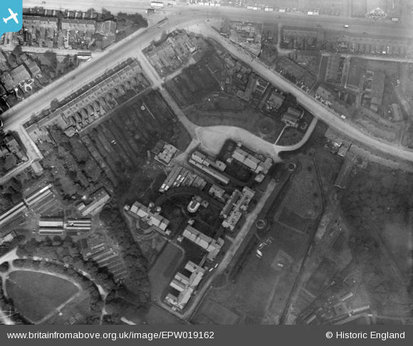
EPW019162 ENGLAND (1927). The Bolton Infirmary, Bolton, 1927
© Copyright OpenStreetMap contributors and licensed by the OpenStreetMap Foundation. 2025. Cartography is licensed as CC BY-SA.
Nearby Images (12)
Details
| Title | [EPW019162] The Bolton Infirmary, Bolton, 1927 |
| Reference | EPW019162 |
| Date | August-1927 |
| Link | |
| Place name | BOLTON |
| Parish | |
| District | |
| Country | ENGLAND |
| Easting / Northing | 370933, 409493 |
| Longitude / Latitude | -2.4390820798324, 53.580982703532 |
| National Grid Reference | SD709095 |


![[EPW019162] The Bolton Infirmary, Bolton, 1927](http://britainfromabove.org.uk/sites/all/libraries/aerofilms-images/public/100x100/EPW/019/EPW019162.jpg)
![[EPW019165] The Bolton Infirmary, Bolton, 1927](http://britainfromabove.org.uk/sites/all/libraries/aerofilms-images/public/100x100/EPW/019/EPW019165.jpg)
![[EPW019169] The Bolton Infirmary, Bolton, 1927](http://britainfromabove.org.uk/sites/all/libraries/aerofilms-images/public/100x100/EPW/019/EPW019169.jpg)
![[EPW019166] The Bolton Infirmary, Bolton, 1927](http://britainfromabove.org.uk/sites/all/libraries/aerofilms-images/public/100x100/EPW/019/EPW019166.jpg)
![[EPW019163] The Bolton Infirmary, Bolton, 1927](http://britainfromabove.org.uk/sites/all/libraries/aerofilms-images/public/100x100/EPW/019/EPW019163.jpg)
![[EPW019167] The Bolton Infirmary and environs, Bolton, 1927](http://britainfromabove.org.uk/sites/all/libraries/aerofilms-images/public/100x100/EPW/019/EPW019167.jpg)
![[EPW019168] The Bolton Infirmary and environs, Bolton, 1927](http://britainfromabove.org.uk/sites/all/libraries/aerofilms-images/public/100x100/EPW/019/EPW019168.jpg)
![[EPW019164] The Bolton Infirmary, Bolton, 1927](http://britainfromabove.org.uk/sites/all/libraries/aerofilms-images/public/100x100/EPW/019/EPW019164.jpg)
![[EAW047049] Industrial premises around Chorley Street and the Royal Bolton Infirmary, Bolton, 1952. This image was marked by Aerofilms Ltd for photo editing.](http://britainfromabove.org.uk/sites/all/libraries/aerofilms-images/public/100x100/EAW/047/EAW047049.jpg)
![[EAW047046] Industrial premises around Chorley Street and the Bolton Royal Infirmary, Bolton, 1952. This image was marked by Aerofilms Ltd for photo editing.](http://britainfromabove.org.uk/sites/all/libraries/aerofilms-images/public/100x100/EAW/047/EAW047046.jpg)
![[EAW047044] Industrial premises around Chorley Street and the Bolton Royal Infirmary, Bolton, 1952. This image was marked by Aerofilms Ltd for photo editing.](http://britainfromabove.org.uk/sites/all/libraries/aerofilms-images/public/100x100/EAW/047/EAW047044.jpg)
![[EAW047047] Industrial premises around Chorley Street including the William Kay (Bolton) Ltd Minerva Saw Mills, Bolton, 1952. This image was marked by Aerofilms Ltd for photo editing.](http://britainfromabove.org.uk/sites/all/libraries/aerofilms-images/public/100x100/EAW/047/EAW047047.jpg)
