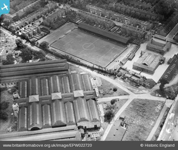
EPW022720 ENGLAND (1928). Queen's Park Rangers FC Football Ground at Loftus Road, Shepherd's Bush, 1928
© Copyright OpenStreetMap contributors and licensed by the OpenStreetMap Foundation. 2024. Cartography is licensed as CC BY-SA.
Nearby Images (7)
Details
| Title | [EPW022720] Queen's Park Rangers FC Football Ground at Loftus Road, Shepherd's Bush, 1928 |
| Reference | EPW022720 |
| Date | August-1928 |
| Link | |
| Place name | SHEPHERD'S BUSH |
| Parish | |
| District | |
| Country | ENGLAND |
| Easting / Northing | 522737, 180447 |
| Longitude / Latitude | -0.23119401691423, 51.509122078683 |
| National Grid Reference | TQ227804 |
Pins
User Comment Contributions
 Paulie |
Saturday 7th of July 2012 04:11:41 PM |


![[EPW022720] Queen's Park Rangers FC Football Ground at Loftus Road, Shepherd's Bush, 1928](http://britainfromabove.org.uk/sites/all/libraries/aerofilms-images/public/100x100/EPW/022/EPW022720.jpg)
![[EAW005411] The White City Estate and Loftus Road Football Ground, Shepherd's Bush, from the south, 1947](http://britainfromabove.org.uk/sites/all/libraries/aerofilms-images/public/100x100/EAW/005/EAW005411.jpg)
![[EPW022719] Queen's Park Rangers FC Football Ground at Loftus Road, Shepherd's Bush, 1928](http://britainfromabove.org.uk/sites/all/libraries/aerofilms-images/public/100x100/EPW/022/EPW022719.jpg)
![[EPW062152] The London County Council White City Estate and the Olympic Stadium, Shepherd's Bush, from the south-west, 1939](http://britainfromabove.org.uk/sites/all/libraries/aerofilms-images/public/100x100/EPW/062/EPW062152.jpg)
![[EAW005413] The White City Estate and environs, Shepherd's Bush, 1947. This image was marked by Aerofilms Ltd for photo editing.](http://britainfromabove.org.uk/sites/all/libraries/aerofilms-images/public/100x100/EAW/005/EAW005413.jpg)
![[EAW005410] The White City Estate and White City Stadium, Shepherd's Bush, from the south, 1947](http://britainfromabove.org.uk/sites/all/libraries/aerofilms-images/public/100x100/EAW/005/EAW005410.jpg)
![[EPW022570] White City and the residential area around Uxbridge Road, Shepherd's Bush, 1928. This image has been produced from a print.](http://britainfromabove.org.uk/sites/all/libraries/aerofilms-images/public/100x100/EPW/022/EPW022570.jpg)
