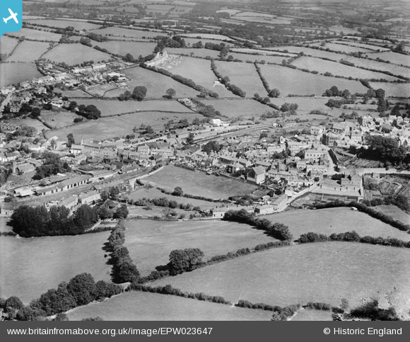
EPW023647 ENGLAND (1928). St Thomas, Launceston, 1928
© Copyright OpenStreetMap contributors and licensed by the OpenStreetMap Foundation. 2025. Cartography is licensed as CC BY-SA.
Details
| Title | [EPW023647] St Thomas, Launceston, 1928 |
| Reference | EPW023647 |
| Date | September-1928 |
| Link | |
| Place name | LAUNCESTON |
| Parish | LAUNCESTON |
| District | |
| Country | ENGLAND |
| Easting / Northing | 232936, 84941 |
| Longitude / Latitude | -4.3629610627292, 50.639598652667 |
| National Grid Reference | SX329849 |
Pins
 Class31 |
Saturday 1st of December 2012 05:59:03 AM | |
 Class31 |
Saturday 1st of December 2012 05:58:21 AM | |
 Class31 |
Saturday 1st of December 2012 05:54:04 AM | |
 Class31 |
Saturday 1st of December 2012 05:51:52 AM | |
 Class31 |
Saturday 1st of December 2012 05:50:51 AM | |
 MB |
Monday 3rd of September 2012 10:25:12 AM | |
 MB |
Monday 3rd of September 2012 10:22:30 AM | |
 Nowy Paul |
Tuesday 21st of August 2012 08:38:40 PM | |
 Nowy Paul |
Tuesday 21st of August 2012 08:31:59 PM | |
This Station was a through station. |
 Nowy Paul |
Tuesday 21st of August 2012 08:46:17 PM |
 Nowy Paul |
Tuesday 21st of August 2012 08:31:09 PM | |
This station was a terminus. |
 Nowy Paul |
Tuesday 21st of August 2012 08:46:57 PM |


![[EPW023647] St Thomas, Launceston, 1928](http://britainfromabove.org.uk/sites/all/libraries/aerofilms-images/public/100x100/EPW/023/EPW023647.jpg)
![[EPW054780] The town, Launceston, from the north-west, 1937](http://britainfromabove.org.uk/sites/all/libraries/aerofilms-images/public/100x100/EPW/054/EPW054780.jpg)
![[EPW023644] St Thomas Hill, Launceston, from the north-west, 1928](http://britainfromabove.org.uk/sites/all/libraries/aerofilms-images/public/100x100/EPW/023/EPW023644.jpg)
![[EAW014991] Launceston Castle above the town, Launceston, 1948. This image has been produced from a print.](http://britainfromabove.org.uk/sites/all/libraries/aerofilms-images/public/100x100/EAW/014/EAW014991.jpg)