
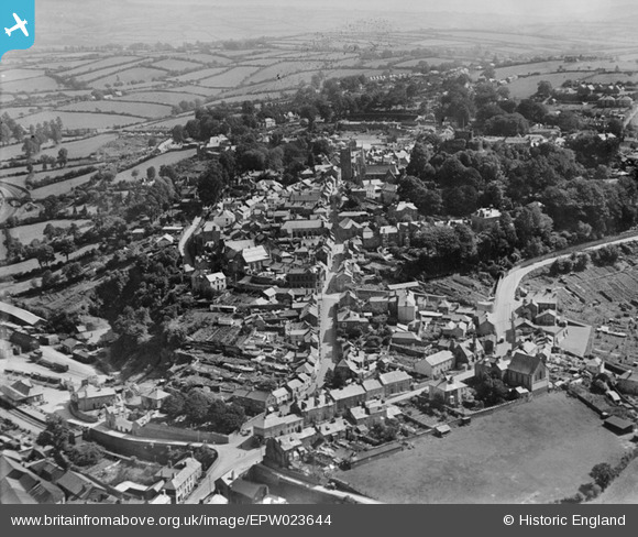
EPW023644 ENGLAND (1928). St Thomas Hill, Launceston, from the north-west, 1928
© Copyright OpenStreetMap contributors and licensed by the OpenStreetMap Foundation. 2025. Cartography is licensed as CC BY-SA.
Nearby Images (9)
EPW023644

EPW023647

EPW054780

EAW014991

EPW054782

EPW054781

EAW005837

EAW005838

EPW023650

Details
| Title | [EPW023644] St Thomas Hill, Launceston, from the north-west, 1928 |
| Reference | EPW023644 |
| Date | September-1928 |
| Link | |
| Place name | LAUNCESTON |
| Parish | LAUNCESTON |
| District | |
| Country | ENGLAND |
| Easting / Northing | 232977, 84895 |
| Longitude / Latitude | -4.3623609482142, 50.639197041691 |
| National Grid Reference | SX330849 |
Pins
 Class31 |
Saturday 1st of December 2012 06:16:14 AM | |
Class31 |
Saturday 1st of December 2012 06:14:56 AM | |
Class31 |
Saturday 1st of December 2012 06:13:35 AM | |
Class31 |
Saturday 1st of December 2012 06:08:21 AM | |
Class31 |
Saturday 1st of December 2012 06:07:16 AM | |
Class31 |
Saturday 1st of December 2012 06:06:46 AM |