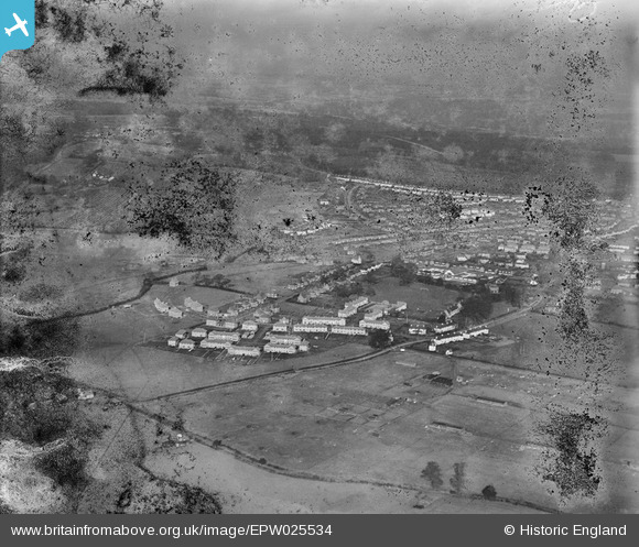
EPW025534 ENGLAND (1928). Handside, Welwyn Garden City, from the south, 1928. This image has been produced from a damaged negative.
© Copyright OpenStreetMap contributors and licensed by the OpenStreetMap Foundation. 2025. Cartography is licensed as CC BY-SA.
Nearby Images (9)
Details
| Title | [EPW025534] Handside, Welwyn Garden City, from the south, 1928. This image has been produced from a damaged negative. |
| Reference | EPW025534 |
| Date | November-1928 |
| Link | |
| Place name | WELWYN GARDEN CITY |
| Parish | |
| District | |
| Country | ENGLAND |
| Easting / Northing | 522830, 212073 |
| Longitude / Latitude | -0.21874428575246, 51.793354852096 |
| National Grid Reference | TL228121 |
Pins
Be the first to add a comment to this image!


![[EPW025534] Handside, Welwyn Garden City, from the south, 1928. This image has been produced from a damaged negative.](http://britainfromabove.org.uk/sites/all/libraries/aerofilms-images/public/100x100/EPW/025/EPW025534.jpg)
![[EPW047343] The town, Welwyn Garden City, from the south-west, 1935](http://britainfromabove.org.uk/sites/all/libraries/aerofilms-images/public/100x100/EPW/047/EPW047343.jpg)
![[EPW022037] Elmwood and Attimore Road residences, Welwyn Garden City, 1928](http://britainfromabove.org.uk/sites/all/libraries/aerofilms-images/public/100x100/EPW/022/EPW022037.jpg)
![[EPW062070] Handside and the town centre, Welwyn Garden City, from the south, 1939](http://britainfromabove.org.uk/sites/all/libraries/aerofilms-images/public/100x100/EPW/062/EPW062070.jpg)
![[EPW022039] Elmwood and Attimore Road residences, Welwyn Garden City, 1928](http://britainfromabove.org.uk/sites/all/libraries/aerofilms-images/public/100x100/EPW/022/EPW022039.jpg)
![[EPW047344] The town, Welwyn Garden City, from the south-west, 1935](http://britainfromabove.org.uk/sites/all/libraries/aerofilms-images/public/100x100/EPW/047/EPW047344.jpg)
![[EPW047346] The town, Welwyn Garden City, from the south-west, 1935](http://britainfromabove.org.uk/sites/all/libraries/aerofilms-images/public/100x100/EPW/047/EPW047346.jpg)
![[EPW047350] Elmwood and environs, Welwyn Garden City, 1935](http://britainfromabove.org.uk/sites/all/libraries/aerofilms-images/public/100x100/EPW/047/EPW047350.jpg)
![[EAW035462] The town and surrounding countryside, Welwyn Garden City, from the west, 1951. This image has been produced from a print marked by Aerofilms Ltd for photo editing.](http://britainfromabove.org.uk/sites/all/libraries/aerofilms-images/public/100x100/EAW/035/EAW035462.jpg)