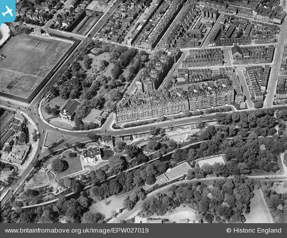
EPW027019 ENGLAND (1929). North Gate, St John the Baptist's Church and environs, St John's Wood, 1929
© Copyright OpenStreetMap contributors and licensed by the OpenStreetMap Foundation. 2025. Cartography is licensed as CC BY-SA.
Nearby Images (13)
Details
| Title | [EPW027019] North Gate, St John the Baptist's Church and environs, St John's Wood, 1929 |
| Reference | EPW027019 |
| Date | May-1929 |
| Link | |
| Place name | ST JOHN'S WOOD |
| Parish | |
| District | |
| Country | ENGLAND |
| Easting / Northing | 527215, 183005 |
| Longitude / Latitude | -0.16577126423126, 51.531122452732 |
| National Grid Reference | TQ272830 |
Pins
 v6tek |
Saturday 29th of May 2021 12:33:13 AM |


![[EPW027019] North Gate, St John the Baptist's Church and environs, St John's Wood, 1929](http://britainfromabove.org.uk/sites/all/libraries/aerofilms-images/public/100x100/EPW/027/EPW027019.jpg)
![[EPW027020] North Gate, St John the Baptist's Church and environs, St John's Wood, 1929](http://britainfromabove.org.uk/sites/all/libraries/aerofilms-images/public/100x100/EPW/027/EPW027020.jpg)
![[EPW027022] North Gate, Lord's Cricket Ground and Regent's Park, St John's Wood, 1929](http://britainfromabove.org.uk/sites/all/libraries/aerofilms-images/public/100x100/EPW/027/EPW027022.jpg)
![[EPW027024] North Gate, Regent's Park and environs, St John's Wood, 1929](http://britainfromabove.org.uk/sites/all/libraries/aerofilms-images/public/100x100/EPW/027/EPW027024.jpg)
![[EPW027023] North Gate, Lord's Cricket Ground and Regent's Park, St John's Wood, 1929](http://britainfromabove.org.uk/sites/all/libraries/aerofilms-images/public/100x100/EPW/027/EPW027023.jpg)
![[EPW027021] North Gate, Lord's Cricket Ground and Regent's Park, St John's Wood, 1929](http://britainfromabove.org.uk/sites/all/libraries/aerofilms-images/public/100x100/EPW/027/EPW027021.jpg)
![[EPW027026] North Gate, Lord's Cricket Ground and Regent's Park, St John's Wood, 1929](http://britainfromabove.org.uk/sites/all/libraries/aerofilms-images/public/100x100/EPW/027/EPW027026.jpg)
![[EPW027018] North Gate, Lord's Cricket Ground and Regent's Park, St John's Wood, 1929](http://britainfromabove.org.uk/sites/all/libraries/aerofilms-images/public/100x100/EPW/027/EPW027018.jpg)
![[EPW027025] North Gate, Lord's Cricket Ground and Regent's Park, St John's Wood, 1929](http://britainfromabove.org.uk/sites/all/libraries/aerofilms-images/public/100x100/EPW/027/EPW027025.jpg)
![[EAW018354] Wellington Road and environs, St John's Wood, from the east, 1948. This image has been produced from a print.](http://britainfromabove.org.uk/sites/all/libraries/aerofilms-images/public/100x100/EAW/018/EAW018354.jpg)
![[EAW044240] Lord's Cricket Ground and the surrounding area, St John's Wood, 1952](http://britainfromabove.org.uk/sites/all/libraries/aerofilms-images/public/100x100/EAW/044/EAW044240.jpg)
![[EPW005641] St John's Chapel Grave Yard and Lord's Cricket Ground, St John's Wood, 1921](http://britainfromabove.org.uk/sites/all/libraries/aerofilms-images/public/100x100/EPW/005/EPW005641.jpg)
![[EAW018355] North Gate, Wellington Road and environs, St John's Wood, from the south-east, 1948. This image has been produced from a print.](http://britainfromabove.org.uk/sites/all/libraries/aerofilms-images/public/100x100/EAW/018/EAW018355.jpg)