
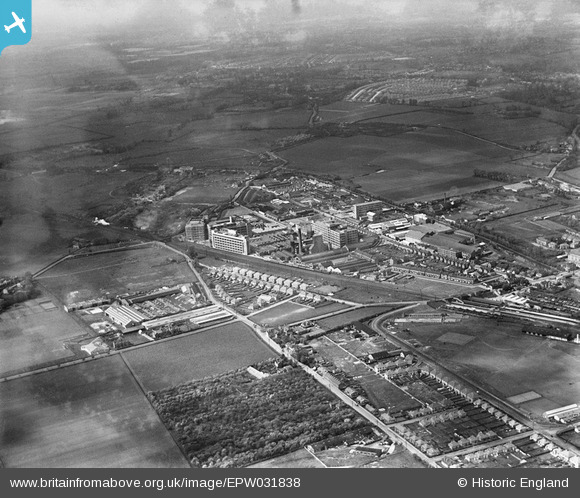
EPW031838 ENGLAND (1930). Gramophone Company (HMV) factory buildings and environs, Hayes, from the south-east, 1930
© Copyright OpenStreetMap contributors and licensed by the OpenStreetMap Foundation. 2025. Cartography is licensed as CC BY-SA.
Nearby Images (5)
EPW031838
 factory buildings and environs, Hayes, from the south-east, 1930")
EPW031837
 factory buildings and environs, Hayes, from the south-east, 1930")
EPW037574

EPW037589

EPR000461

Details
| Title | [EPW031838] Gramophone Company (HMV) factory buildings and environs, Hayes, from the south-east, 1930 |
| Reference | EPW031838 |
| Date | 7-May-1930 |
| Link | |
| Place name | HAYES |
| Parish | |
| District | |
| Country | ENGLAND |
| Easting / Northing | 509637, 179172 |
| Longitude / Latitude | -0.42029734046678, 51.500355318586 |
| National Grid Reference | TQ096792 |
Pins
 The Laird |
Saturday 5th of March 2016 04:19:10 PM | |
The Laird |
Saturday 5th of March 2016 04:10:34 PM | |
The Laird |
Saturday 5th of March 2016 04:06:26 PM | |
 Class31 |
Monday 7th of October 2013 03:43:57 PM | |
Class31 |
Monday 7th of October 2013 03:42:36 PM |