
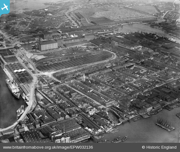
EPW032136 ENGLAND (1930). The Western Granaries and Grain Depot at Millwall Inner Dock, Millwall, 1930
© Copyright OpenStreetMap contributors and licensed by the OpenStreetMap Foundation. 2025. Cartography is licensed as CC BY-SA.
Nearby Images (12)
EPW032136

EPW032140

EPW032143

EPW032141

EPW032138

EPW032137

EPW032139

EPW032142

EPW044135

EAW009114

EPW044128

EAW045808

Details
| Title | [EPW032136] The Western Granaries and Grain Depot at Millwall Inner Dock, Millwall, 1930 |
| Reference | EPW032136 |
| Date | May-1930 |
| Link | |
| Place name | MILLWALL |
| Parish | |
| District | |
| Country | ENGLAND |
| Easting / Northing | 537370, 179676 |
| Longitude / Latitude | -0.020741204449109, 51.498824663662 |
| National Grid Reference | TQ374797 |
Pins
 FREDSDAD |
Thursday 5th of May 2022 09:41:11 PM | |
moses72 |
Thursday 1st of October 2015 11:13:03 AM | |
moses72 |
Friday 21st of June 2013 01:45:41 PM | |
moses72 |
Friday 21st of June 2013 01:44:52 PM | |
moses72 |
Friday 21st of June 2013 01:43:03 PM | |
moses72 |
Friday 21st of June 2013 01:40:27 PM | |
moses72 |
Friday 21st of June 2013 01:39:37 PM | |
moses72 |
Friday 21st of June 2013 01:38:57 PM | |
moses72 |
Friday 21st of June 2013 01:38:08 PM | |
moses72 |
Friday 21st of June 2013 01:35:23 PM | |
PeterJames |
Monday 31st of December 2012 06:53:07 PM |