
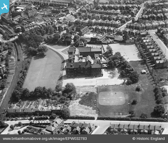
EPW032783 ENGLAND (1930). The Jews' Hospital and Orphan Asylum, Streatham, 1930
© Copyright OpenStreetMap contributors and licensed by the OpenStreetMap Foundation. 2025. Cartography is licensed as CC BY-SA.
Nearby Images (5)
EPW032783

EPW032784

EPW032780

EPW032778

EPW032779

Details
| Title | [EPW032783] The Jews' Hospital and Orphan Asylum, Streatham, 1930 |
| Reference | EPW032783 |
| Date | June-1930 |
| Link | |
| Place name | STREATHAM |
| Parish | |
| District | |
| Country | ENGLAND |
| Easting / Northing | 531697, 172096 |
| Longitude / Latitude | -0.10525448693279, 51.432048870574 |
| National Grid Reference | TQ317721 |
Pins
 Leslie B |
Saturday 12th of March 2016 11:57:58 PM |