
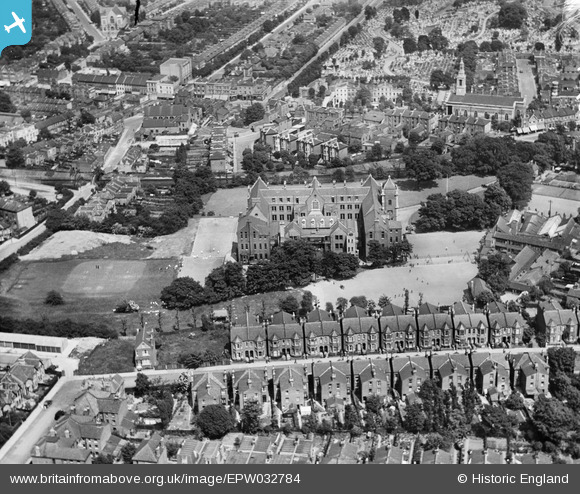
EPW032784 ENGLAND (1930). The Jews' Hospital and Orphan Asylum, Streatham, 1930
© Copyright OpenStreetMap contributors and licensed by the OpenStreetMap Foundation. 2025. Cartography is licensed as CC BY-SA.
Nearby Images (5)
EPW032784

EPW032783

EPW032778

EPW032780

EPW032779

Details
| Title | [EPW032784] The Jews' Hospital and Orphan Asylum, Streatham, 1930 |
| Reference | EPW032784 |
| Date | June-1930 |
| Link | |
| Place name | STREATHAM |
| Parish | |
| District | |
| Country | ENGLAND |
| Easting / Northing | 531690, 172071 |
| Longitude / Latitude | -0.10536443511678, 51.431825805567 |
| National Grid Reference | TQ317721 |
Pins
 AirSpotterJones |
Wednesday 27th of March 2019 01:09:50 PM | |
AirSpotterJones |
Wednesday 27th of March 2019 12:19:48 PM | |
brianbeckett |
Thursday 18th of September 2014 08:20:46 AM | |
brianbeckett |
Thursday 18th of September 2014 08:20:22 AM |