
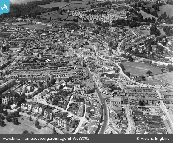
EPW033392 ENGLAND (1930). The South Devon Cricket Ground and the town centre, Newton Abbot, 1930
© Copyright OpenStreetMap contributors and licensed by the OpenStreetMap Foundation. 2025. Cartography is licensed as CC BY-SA.
Nearby Images (7)
EPW033392

EPW033393

EPW039817

EPW033394

EPW039816

EPW039820

EPW023613

Details
| Title | [EPW033392] The South Devon Cricket Ground and the town centre, Newton Abbot, 1930 |
| Reference | EPW033392 |
| Date | July-1930 |
| Link | |
| Place name | NEWTON ABBOT |
| Parish | NEWTON ABBOT |
| District | |
| Country | ENGLAND |
| Easting / Northing | 286216, 71343 |
| Longitude / Latitude | -3.6055928383313, 50.530191083063 |
| National Grid Reference | SX862713 |
