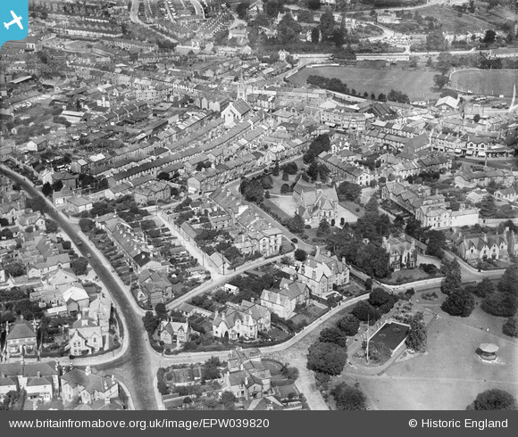
EPW039820 ENGLAND (1932). St Paul's Church, Devon Square and environs, Newton Abbot, 1932
© Copyright OpenStreetMap contributors and licensed by the OpenStreetMap Foundation. 2025. Cartography is licensed as CC BY-SA.
Nearby Images (7)
EPW039820

EPW023613

EPW039817

EPW033394

EPW033398

EPW033392

EPW039816

Details
| Title | [EPW039820] St Paul's Church, Devon Square and environs, Newton Abbot, 1932 |
| Reference | EPW039820 |
| Date | August-1932 |
| Link | |
| Place name | NEWTON ABBOT |
| Parish | NEWTON ABBOT |
| District | |
| Country | ENGLAND |
| Easting / Northing | 286395, 71176 |
| Longitude / Latitude | -3.6030171561395, 50.528724467792 |
| National Grid Reference | SX864712 |
Pins
 Class31 |
Tuesday 23rd of July 2013 10:49:11 AM | |
 hydrargyrum |
Sunday 16th of June 2013 12:49:42 PM | |
hydrargyrum |
Sunday 16th of June 2013 12:48:54 PM | |
hydrargyrum |
Sunday 16th of June 2013 12:47:33 PM |