
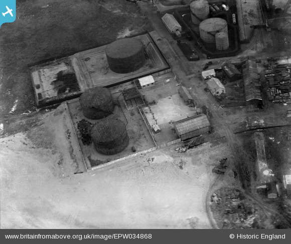
EPW034868 ENGLAND (1931). Watsons ROP oil storage depot at the entrance to Preston Docks, Preston, 1931
© Copyright OpenStreetMap contributors and licensed by the OpenStreetMap Foundation. 2025. Cartography is licensed as CC BY-SA.
Nearby Images (20)
EPW034868

EPW034867

EPW034865

EPW034863

EPW034866

EPW034864

EPW034869

EPW034871

EPW034870

EPW038880

EPW038853

EAW050355

EPW038882

EAW050356

EPW038881

EAW050364

EAW050357

EAW050358

EAW050361

EAW050363

Details
| Title | [EPW034868] Watsons ROP oil storage depot at the entrance to Preston Docks, Preston, 1931 |
| Reference | EPW034868 |
| Date | 4-March-1931 |
| Link | |
| Place name | PRESTON |
| Parish | |
| District | |
| Country | ENGLAND |
| Easting / Northing | 350405, 429511 |
| Longitude / Latitude | -2.7523507089259, 53.7593734457 |
| National Grid Reference | SD504295 |
Pins
 Class31 |
Thursday 10th of January 2013 09:09:56 PM |