
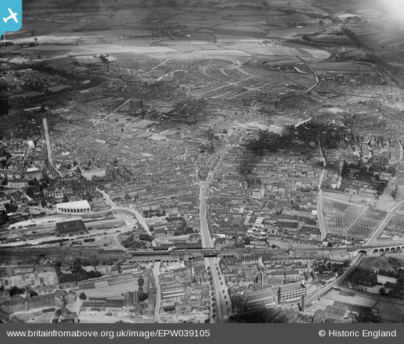
EPW039105 ENGLAND (1932). Westgate and the city centre, Wakefield, 1932
© Copyright OpenStreetMap contributors and licensed by the OpenStreetMap Foundation. 2025. Cartography is licensed as CC BY-SA.
Nearby Images (17)
EPW039105

EAW015515

EPW039106

EPW039104

EPW016287

EPW039103

EAW015513

EPW016289

EAW025172

EAW015514

EPW016285

EAW015510

EAW015516

EAW025171

EPW061508

EAW015512

EAW015511

Details
| Title | [EPW039105] Westgate and the city centre, Wakefield, 1932 |
| Reference | EPW039105 |
| Date | July-1932 |
| Link | |
| Place name | WAKEFIELD |
| Parish | |
| District | |
| Country | ENGLAND |
| Easting / Northing | 433199, 420829 |
| Longitude / Latitude | -1.4972931915162, 53.682635741452 |
| National Grid Reference | SE332208 |
Pins
 Consort |
Friday 12th of June 2020 07:48:26 PM |