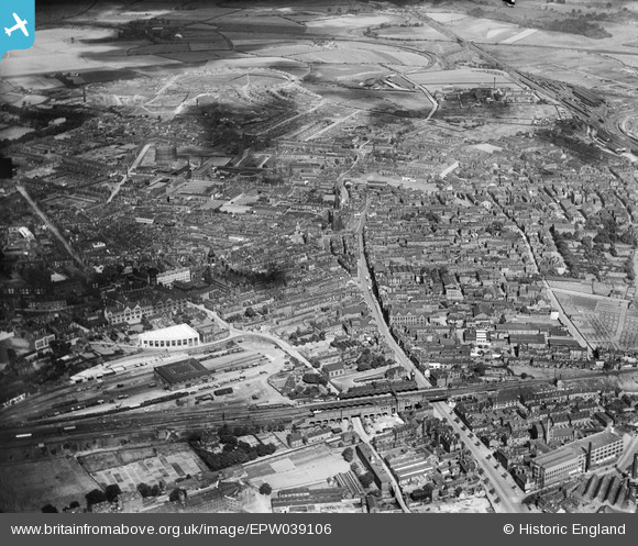
EPW039106 ENGLAND (1932). Westgate and the city centre, Wakefield, 1932
© Copyright OpenStreetMap contributors and licensed by the OpenStreetMap Foundation. 2025. Cartography is licensed as CC BY-SA.
Nearby Images (14)
Details
| Title | [EPW039106] Westgate and the city centre, Wakefield, 1932 |
| Reference | EPW039106 |
| Date | July-1932 |
| Link | |
| Place name | WAKEFIELD |
| Parish | |
| District | |
| Country | ENGLAND |
| Easting / Northing | 433142, 420848 |
| Longitude / Latitude | -1.4981542316178, 53.682810148603 |
| National Grid Reference | SE331208 |
Pins
 trevorsboy |
Tuesday 15th of March 2016 08:09:51 PM |


![[EPW039106] Westgate and the city centre, Wakefield, 1932](http://britainfromabove.org.uk/sites/all/libraries/aerofilms-images/public/100x100/EPW/039/EPW039106.jpg)
![[EAW015515] The city centre, Wakefield, from the west, 1948. This image has been produced from a print.](http://britainfromabove.org.uk/sites/all/libraries/aerofilms-images/public/100x100/EAW/015/EAW015515.jpg)
![[EPW039105] Westgate and the city centre, Wakefield, 1932](http://britainfromabove.org.uk/sites/all/libraries/aerofilms-images/public/100x100/EPW/039/EPW039105.jpg)
![[EAW015514] The city centre, Wakefield, from the west, 1948. This image has been produced from a print.](http://britainfromabove.org.uk/sites/all/libraries/aerofilms-images/public/100x100/EAW/015/EAW015514.jpg)
![[EPW016287] The Bull Ring and All Saints' Cathedral, Wakefield, 1926](http://britainfromabove.org.uk/sites/all/libraries/aerofilms-images/public/100x100/EPW/016/EPW016287.jpg)
![[EPW039104] The city centre, Wakefield, 1932](http://britainfromabove.org.uk/sites/all/libraries/aerofilms-images/public/100x100/EPW/039/EPW039104.jpg)
![[EAW015513] The city centre, Wakefield, 1948. This image has been produced from a print.](http://britainfromabove.org.uk/sites/all/libraries/aerofilms-images/public/100x100/EAW/015/EAW015513.jpg)
![[EPW039103] Westgate Railway Station, Westgate and the city centre, Wakefield, 1932](http://britainfromabove.org.uk/sites/all/libraries/aerofilms-images/public/100x100/EPW/039/EPW039103.jpg)
![[EPW016289] All Saints Cathedral and environs, Wakefield, 1926. This image has been produced from a copy-negative.](http://britainfromabove.org.uk/sites/all/libraries/aerofilms-images/public/100x100/EPW/016/EPW016289.jpg)
![[EAW025171] County Hall, the Town Hall and streets around Westgate, Wakefield, from the south-east, 1949](http://britainfromabove.org.uk/sites/all/libraries/aerofilms-images/public/100x100/EAW/025/EAW025171.jpg)
![[EAW025172] The Cathedral Church of All Saints and surrounding streets, Wakefield, from the south-east, 1949](http://britainfromabove.org.uk/sites/all/libraries/aerofilms-images/public/100x100/EAW/025/EAW025172.jpg)
![[EPW016285] All Saints' Cathedral, Wakefield, 1926](http://britainfromabove.org.uk/sites/all/libraries/aerofilms-images/public/100x100/EPW/016/EPW016285.jpg)
![[EAW015510] The city centre, Wakefield, from the north, 1948. This image has been produced from a print.](http://britainfromabove.org.uk/sites/all/libraries/aerofilms-images/public/100x100/EAW/015/EAW015510.jpg)
![[EAW015516] The city centre, Wakefield, from the south, 1948. This image has been produced from a print.](http://britainfromabove.org.uk/sites/all/libraries/aerofilms-images/public/100x100/EAW/015/EAW015516.jpg)