
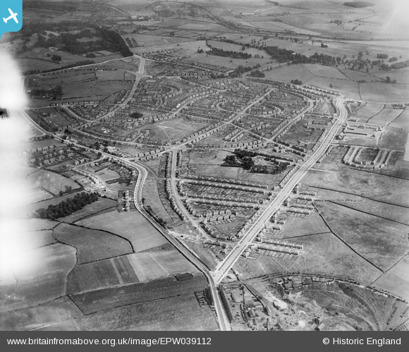
EPW039112 ENGLAND (1932). The Lupset housing estate, Lupset, 1932
© Copyright OpenStreetMap contributors and licensed by the OpenStreetMap Foundation. 2025. Cartography is licensed as CC BY-SA.
Nearby Images (4)
EPW039112

EPW039113

EPW039111

EPW039114

Details
| Title | [EPW039112] The Lupset housing estate, Lupset, 1932 |
| Reference | EPW039112 |
| Date | July-1932 |
| Link | |
| Place name | LUPSET |
| Parish | |
| District | |
| Country | ENGLAND |
| Easting / Northing | 430684, 420099 |
| Longitude / Latitude | -1.535446670585, 53.676227619468 |
| National Grid Reference | SE307201 |
Pins
Be the first to add a comment to this image!