
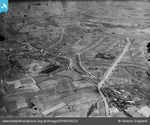
EPW039113 ENGLAND (1932). The Lupset housing estate, Lupset, 1932. This image has been produced from a damaged negative.
© Copyright OpenStreetMap contributors and licensed by the OpenStreetMap Foundation. 2025. Cartography is licensed as CC BY-SA.
Nearby Images (2)
EPW039113

EPW039112

Details
| Title | [EPW039113] The Lupset housing estate, Lupset, 1932. This image has been produced from a damaged negative. |
| Reference | EPW039113 |
| Date | July-1932 |
| Link | |
| Place name | LUPSET |
| Parish | |
| District | |
| Country | ENGLAND |
| Easting / Northing | 430759, 420217 |
| Longitude / Latitude | -1.5342995186878, 53.677283900004 |
| National Grid Reference | SE308202 |
Pins
Be the first to add a comment to this image!