
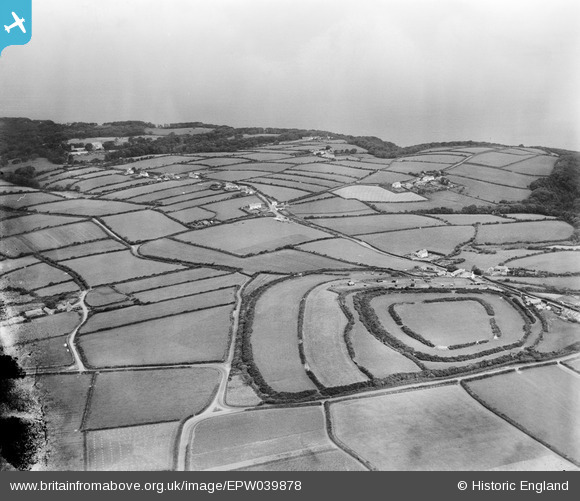
EPW039878 ENGLAND (1932). Clovelly Dykes Hillfort and surrounding countryside, Higher Clovelly, from the south-west, 1932
© Copyright OpenStreetMap contributors and licensed by the OpenStreetMap Foundation. 2025. Cartography is licensed as CC BY-SA.
Nearby Images (5)
EPW039878

EPW039881

EPW039877

EPW039880

EPW039879

Details
| Title | [EPW039878] Clovelly Dykes Hillfort and surrounding countryside, Higher Clovelly, from the south-west, 1932 |
| Reference | EPW039878 |
| Date | August-1932 |
| Link | |
| Place name | HIGHER CLOVELLY |
| Parish | CLOVELLY |
| District | |
| Country | ENGLAND |
| Easting / Northing | 231040, 123592 |
| Longitude / Latitude | -4.4075517931537, 50.98635741227 |
| National Grid Reference | SS310236 |
Pins
 totoro |
Tuesday 21st of October 2014 08:34:53 PM | |
totoro |
Tuesday 21st of October 2014 08:34:36 PM | |
totoro |
Tuesday 21st of October 2014 08:23:52 PM | |
Shown on current OS as Winsworthy Cottage |
totoro |
Tuesday 21st of October 2014 08:24:50 PM |
totoro |
Tuesday 21st of October 2014 08:22:02 PM | |
totoro |
Tuesday 21st of October 2014 08:13:07 PM | |
totoro |
Tuesday 21st of October 2014 08:12:31 PM | |
totoro |
Tuesday 21st of October 2014 08:12:06 PM | |
totoro |
Tuesday 21st of October 2014 07:38:56 PM | |
totoro |
Tuesday 21st of October 2014 07:37:49 PM |