
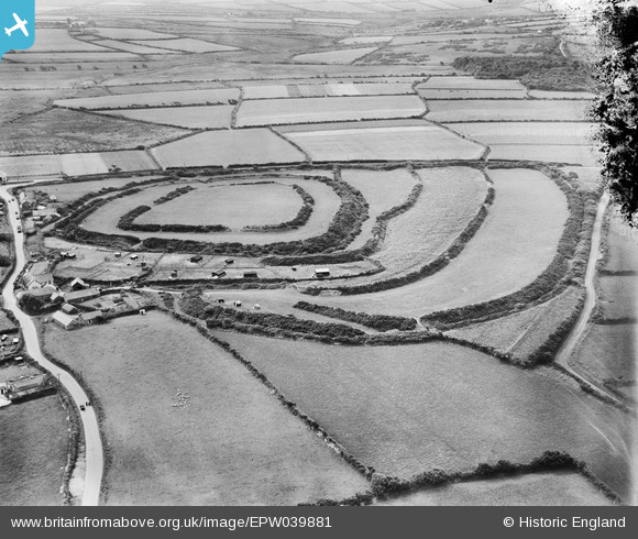
EPW039881 ENGLAND (1932). Clovelly Dykes Hillfort and surrounding countryside, Higher Clovelly, 1932
© Copyright OpenStreetMap contributors and licensed by the OpenStreetMap Foundation. 2025. Cartography is licensed as CC BY-SA.
Nearby Images (5)
EPW039881

EPW039878

EPW039880

EPW039877

EPW039879

Details
| Title | [EPW039881] Clovelly Dykes Hillfort and surrounding countryside, Higher Clovelly, 1932 |
| Reference | EPW039881 |
| Date | August-1932 |
| Link | |
| Place name | HIGHER CLOVELLY |
| Parish | CLOVELLY |
| District | |
| Country | ENGLAND |
| Easting / Northing | 231117, 123552 |
| Longitude / Latitude | -4.4064370432625, 50.986020595164 |
| National Grid Reference | SS311236 |
Pins
Be the first to add a comment to this image!