
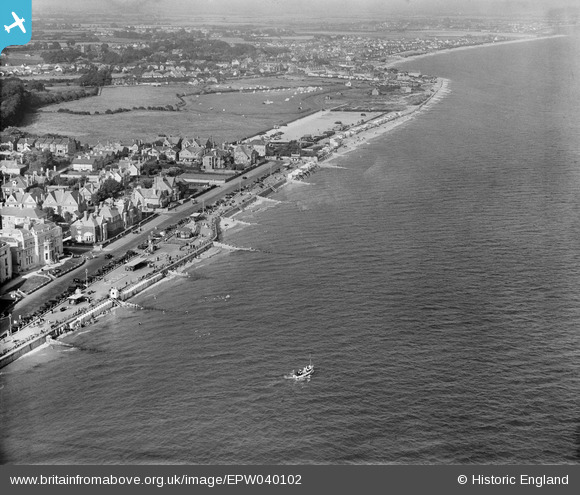
EPW040102 ENGLAND (1932). Marine Drive, East End Car Park and environs, Bognor Regis, from the south-west, 1932
© Copyright OpenStreetMap contributors and licensed by the OpenStreetMap Foundation. 2025. Cartography is licensed as CC BY-SA.
Nearby Images (4)
EPW040102

EAW029567

EAW022235

EAW046805

Details
| Title | [EPW040102] Marine Drive, East End Car Park and environs, Bognor Regis, from the south-west, 1932 |
| Reference | EPW040102 |
| Date | August-1932 |
| Link | |
| Place name | BOGNOR REGIS |
| Parish | BOGNOR REGIS |
| District | |
| Country | ENGLAND |
| Easting / Northing | 493872, 98802 |
| Longitude / Latitude | -0.66833030595444, 50.780620561644 |
| National Grid Reference | SZ939988 |
Pins
 JerryE |
Thursday 17th of October 2013 08:48:33 PM | |
JerryE |
Thursday 17th of October 2013 07:57:59 PM | |
JerryE |
Thursday 17th of October 2013 07:54:00 PM | |
JerryE |
Thursday 17th of October 2013 07:51:01 PM | |
JerryE |
Thursday 17th of October 2013 07:48:20 PM | |
JerryE |
Thursday 17th of October 2013 07:21:22 PM | |
Brian Jones |
Monday 17th of June 2013 02:18:06 PM |
User Comment Contributions
This would be better described as "The Esplanade, East End Car Park and environs", we are looking to the east of the Pier, we know that because it is not visible, Marine Drive is off the bottom left-hand corner of the photo. What is very interesting is this is the clearest view of the (then) little village of Felpham, in the background, at the top of the photo beyond the flag for were Butlin's is now. |
JerryE |
Thursday 17th of October 2013 06:59:25 PM |