
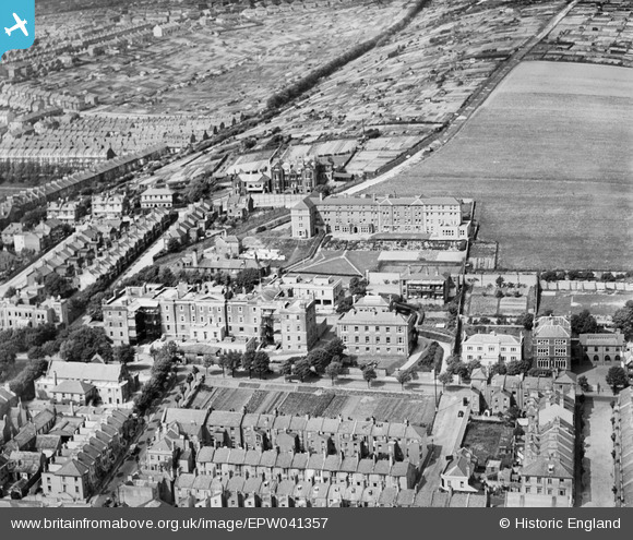
EPW041357 ENGLAND (1933). The Royal Sussex County Hospital, Brighton, 1933
© Copyright OpenStreetMap contributors and licensed by the OpenStreetMap Foundation. 2025. Cartography is licensed as CC BY-SA.
Nearby Images (7)
EPW041357

EPW041356

EPW041359

EPW041358

EPW041355

EPW041354

EPW041360

Details
| Title | [EPW041357] The Royal Sussex County Hospital, Brighton, 1933 |
| Reference | EPW041357 |
| Date | May-1933 |
| Link | |
| Place name | BRIGHTON |
| Parish | |
| District | |
| Country | ENGLAND |
| Easting / Northing | 532689, 103971 |
| Longitude / Latitude | -0.11607480191171, 50.819499500019 |
| National Grid Reference | TQ327040 |
Pins
Be the first to add a comment to this image!
User Comment Contributions
 Royal Sussex County Hospital Brighton |
 Alan McFaden |
Wednesday 19th of November 2014 08:27:04 PM |
First World War Military Hospital |
Lynda Tubbs |
Wednesday 22nd of January 2014 11:35:13 AM |