
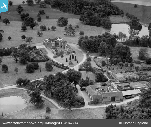
EPW042714 ENGLAND (1933). The Manor House and Dairy Buildings, Freeford Manor, 1933
© Copyright OpenStreetMap contributors and licensed by the OpenStreetMap Foundation. 2025. Cartography is licensed as CC BY-SA.
Nearby Images (6)
EPW042714

EPW042716

EPW042713

EPW042715

EPW042717

EPW042712

Details
| Title | [EPW042714] The Manor House and Dairy Buildings, Freeford Manor, 1933 |
| Reference | EPW042714 |
| Date | August-1933 |
| Link | |
| Place name | FREEFORD MANOR |
| Parish | SWINFEN AND PACKINGTON |
| District | |
| Country | ENGLAND |
| Easting / Northing | 413543, 307618 |
| Longitude / Latitude | -1.7997217924901, 52.665759817247 |
| National Grid Reference | SK135076 |
Pins
Be the first to add a comment to this image!