
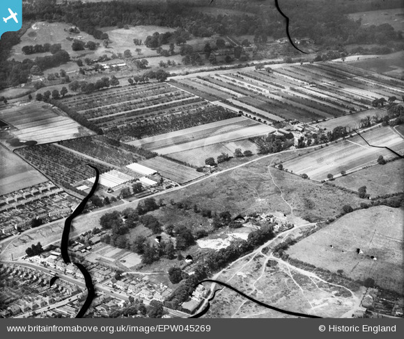
EPW045269 ENGLAND (1934). Old Common, Chestnut Lodge Farm and surrounding farmland, Cobham, 1934. This image has been produced from a damaged negative.
© Copyright OpenStreetMap contributors and licensed by the OpenStreetMap Foundation. 2025. Cartography is licensed as CC BY-SA.
Nearby Images (7)
EPW045269

EPW045270

EPW045267

EPW045263

EPW045262

EPW045266

EPW045264

Details
| Title | [EPW045269] Old Common, Chestnut Lodge Farm and surrounding farmland, Cobham, 1934. This image has been produced from a damaged negative. |
| Reference | EPW045269 |
| Date | July-1934 |
| Link | |
| Place name | COBHAM |
| Parish | |
| District | |
| Country | ENGLAND |
| Easting / Northing | 510489, 161046 |
| Longitude / Latitude | -0.41367801396031, 51.33725168812 |
| National Grid Reference | TQ105610 |
Pins
Be the first to add a comment to this image!