
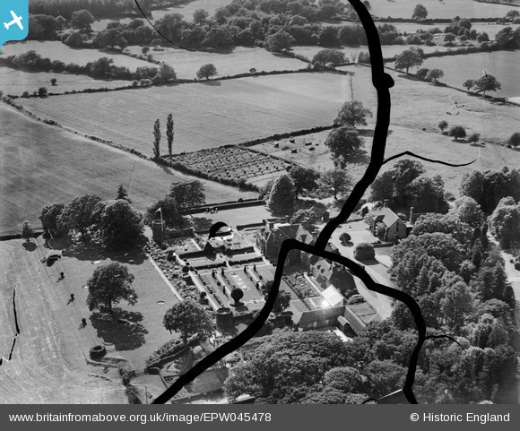
EPW045478 ENGLAND (1934). Isfield Place, Isfield, 1934. This image has been produced from a damaged negative.
© Copyright OpenStreetMap contributors and licensed by the OpenStreetMap Foundation. 2025. Cartography is licensed as CC BY-SA.
Nearby Images (41)
EPW045478

EPW034504

EPW035175

EPW034500

EPW035181

EPW035182

EPW035183

EPW034508

EPW034509

EPW034501

EPW045479

EPW034507

EPW034498

EPW035186

EPW035185

EPW045473

EPW045477

EPW035174

EPW035188

EPW045481

EPW034506

EPW046011

EPW035178

EPW046010

EPW034503

EPW035187

EPW035176

EPW035177

EPW046012

EPW034502

EPW046007

EPW035189

EPW045480

EPW035179

EPW035180

EPW046008

EPW045476

EPW046009

EPW045472

EPW045474

EPW045471

Details
| Title | [EPW045478] Isfield Place, Isfield, 1934. This image has been produced from a damaged negative. |
| Reference | EPW045478 |
| Date | July-1934 |
| Link | |
| Place name | ISFIELD |
| Parish | ISFIELD |
| District | |
| Country | ENGLAND |
| Easting / Northing | 544558, 118454 |
| Longitude / Latitude | 0.058059941778469, 50.946826224499 |
| National Grid Reference | TQ446185 |
Pins
Be the first to add a comment to this image!