
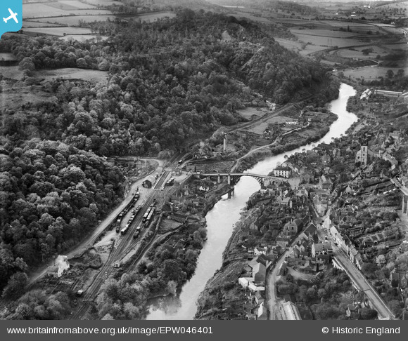
EPW046401 ENGLAND (1934). The Iron Bridge and Ironbridge and Broseley Station, Ironbridge, 1934
© Copyright OpenStreetMap contributors and licensed by the OpenStreetMap Foundation. 2025. Cartography is licensed as CC BY-SA.
Nearby Images (15)
EPW046401

EPW046395

EPW046398

EAW012671

EAW024217

EAW024218

EPW034286

EAW024221

EPW046406

EAW024220

EAW012586

EAW024219

EAW012585

EPW046404

EPW046402

Details
| Title | [EPW046401] The Iron Bridge and Ironbridge and Broseley Station, Ironbridge, 1934 |
| Reference | EPW046401 |
| Date | October-1934 |
| Link | |
| Place name | IRONBRIDGE |
| Parish | THE GORGE |
| District | |
| Country | ENGLAND |
| Easting / Northing | 367178, 303345 |
| Longitude / Latitude | -2.484949215369, 52.626519076551 |
| National Grid Reference | SJ672033 |
Pins
 Rog G |
Wednesday 11th of February 2015 04:52:17 PM | |
oozthajorn |
Sunday 16th of November 2014 09:13:13 PM | |
oozthajorn |
Sunday 16th of November 2014 09:05:57 PM | |
 Alan McFaden |
Friday 12th of July 2013 11:06:09 AM | |
Alan McFaden |
Friday 12th of July 2013 11:05:02 AM |

