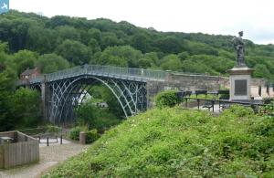
EPW046402 ENGLAND (1934). Ironbridge Gorge, Ironbridge, from the north-west, 1934
© Copyright OpenStreetMap contributors and licensed by the OpenStreetMap Foundation. 2025. Cartography is licensed as CC BY-SA.
Nearby Images (15)
Details
| Title | [EPW046402] Ironbridge Gorge, Ironbridge, from the north-west, 1934 |
| Reference | EPW046402 |
| Date | October-1934 |
| Link | |
| Place name | IRONBRIDGE |
| Parish | THE GORGE |
| District | |
| Country | ENGLAND |
| Easting / Northing | 367355, 303504 |
| Longitude / Latitude | -2.4823498359154, 52.627959235421 |
| National Grid Reference | SJ674035 |
Pins
 Alan McFaden |
Friday 12th of July 2013 11:03:52 AM | |
 Alan McFaden |
Friday 12th of July 2013 11:03:24 AM |


![[EPW046402] Ironbridge Gorge, Ironbridge, from the north-west, 1934](http://britainfromabove.org.uk/sites/all/libraries/aerofilms-images/public/100x100/EPW/046/EPW046402.jpg)
![[EAW012586] The River Severn in flood, Ironbridge, from the north, 1948](http://britainfromabove.org.uk/sites/all/libraries/aerofilms-images/public/100x100/EAW/012/EAW012586.jpg)
![[EPW046406] Ironbridge Gorge, Ironbridge, from the west, 1934](http://britainfromabove.org.uk/sites/all/libraries/aerofilms-images/public/100x100/EPW/046/EPW046406.jpg)
![[EAW024221] The River Severn, Iron Bridge and environs, Ironbridge, 1949](http://britainfromabove.org.uk/sites/all/libraries/aerofilms-images/public/100x100/EAW/024/EAW024221.jpg)
![[EPW034286] The Iron Bridge and Hodgebower, Ironbridge, 1930. This image has been produced from a damaged negative.](http://britainfromabove.org.uk/sites/all/libraries/aerofilms-images/public/100x100/EPW/034/EPW034286.jpg)
![[EPW046404] Ironbridge Gorge, Ironbridge, from the west, 1934](http://britainfromabove.org.uk/sites/all/libraries/aerofilms-images/public/100x100/EPW/046/EPW046404.jpg)
![[EAW024219] The River Severn, Iron Bridge and environs, Ironbridge, 1949](http://britainfromabove.org.uk/sites/all/libraries/aerofilms-images/public/100x100/EAW/024/EAW024219.jpg)
![[EAW024220] The River Severn, Iron Bridge and environs, Ironbridge, 1949](http://britainfromabove.org.uk/sites/all/libraries/aerofilms-images/public/100x100/EAW/024/EAW024220.jpg)
![[EPW046398] The Iron Bridge and town, Ironbridge, 1934](http://britainfromabove.org.uk/sites/all/libraries/aerofilms-images/public/100x100/EPW/046/EPW046398.jpg)
![[EAW024217] The River Severn, Iron Bridge, St Luke's Church and environs, Ironbridge, 1949](http://britainfromabove.org.uk/sites/all/libraries/aerofilms-images/public/100x100/EAW/024/EAW024217.jpg)
![[EAW012671] The River Severn in flood, Ironbridge, 1948](http://britainfromabove.org.uk/sites/all/libraries/aerofilms-images/public/100x100/EAW/012/EAW012671.jpg)
![[EPW046395] The Iron Bridge and town, Ironbridge, 1934](http://britainfromabove.org.uk/sites/all/libraries/aerofilms-images/public/100x100/EPW/046/EPW046395.jpg)
![[EAW024218] The River Severn, Iron Bridge and environs, Ironbridge, 1949](http://britainfromabove.org.uk/sites/all/libraries/aerofilms-images/public/100x100/EAW/024/EAW024218.jpg)
![[EPW046394] Ironbridge Gorge, Ironbridge, from the north-west, 1934](http://britainfromabove.org.uk/sites/all/libraries/aerofilms-images/public/100x100/EPW/046/EPW046394.jpg)
![[EPW046401] The Iron Bridge and Ironbridge and Broseley Station, Ironbridge, 1934](http://britainfromabove.org.uk/sites/all/libraries/aerofilms-images/public/100x100/EPW/046/EPW046401.jpg)

