
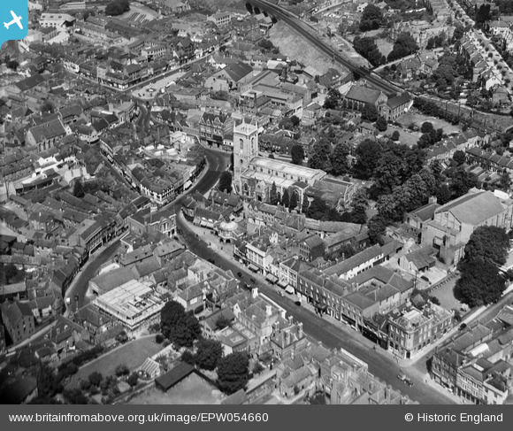
EPW054660 ENGLAND (1937). All Saints' Church and the town centre, High Wycombe, 1937
© Copyright OpenStreetMap contributors and licensed by the OpenStreetMap Foundation. 2025. Cartography is licensed as CC BY-SA.
Nearby Images (6)
EPW054660

EPW017827

EPW017825

EPW054658

EPW054661

EPW052765

Details
| Title | [EPW054660] All Saints' Church and the town centre, High Wycombe, 1937 |
| Reference | EPW054660 |
| Date | 2-August-1937 |
| Link | |
| Place name | HIGH WYCOMBE |
| Parish | |
| District | |
| Country | ENGLAND |
| Easting / Northing | 486562, 193057 |
| Longitude / Latitude | -0.74925605255215, 51.629191199907 |
| National Grid Reference | SU866931 |
Pins
Be the first to add a comment to this image!