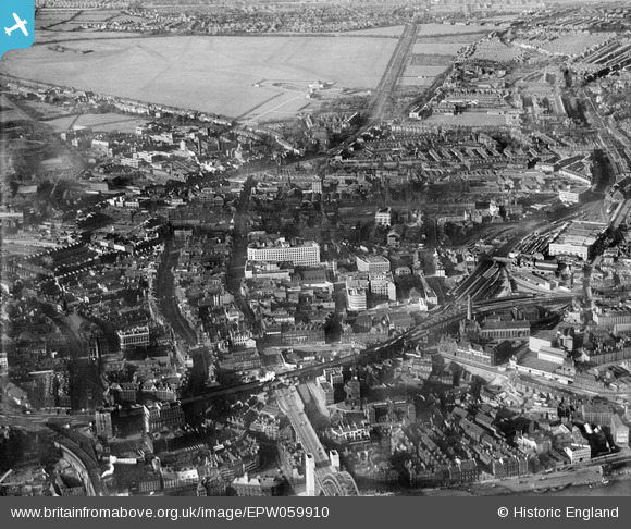
EPW059910 ENGLAND (1938). A cityscape from Pilgrim Street to the Town Moor, Newcastle Upon Tyne, 1938
© Copyright OpenStreetMap contributors and licensed by the OpenStreetMap Foundation. 2024. Cartography is licensed as CC BY-SA.
Nearby Images (13)
Details
| Title | [EPW059910] A cityscape from Pilgrim Street to the Town Moor, Newcastle Upon Tyne, 1938 |
| Reference | EPW059910 |
| Date | 11-October-1938 |
| Link | |
| Place name | NEWCASTLE UPON TYNE |
| Parish | |
| District | |
| Country | ENGLAND |
| Easting / Northing | 425094, 564411 |
| Longitude / Latitude | -1.6079317240932, 54.973605177033 |
| National Grid Reference | NZ251644 |
Pins
 Class31 |
Monday 7th of April 2014 05:39:58 PM |
User Comment Contributions
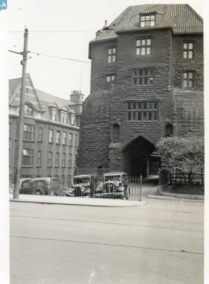
 The Tyne Bridge photographed in June or July 1939 by a relative as part of a holiday album. |
 Class31 |
Wednesday 20th of August 2014 10:10:12 AM |


![[EPW059910] A cityscape from Pilgrim Street to the Town Moor, Newcastle Upon Tyne, 1938](http://britainfromabove.org.uk/sites/all/libraries/aerofilms-images/public/100x100/EPW/059/EPW059910.jpg)
![[EPW059911] A cityscape from Pilgrim Street to the Town Moor, Newcastle Upon Tyne, 1938. This image has been produced from a damaged negative.](http://britainfromabove.org.uk/sites/all/libraries/aerofilms-images/public/100x100/EPW/059/EPW059911.jpg)
![[EPW059908] A cityscape from Pilgrim Street to the Town Moor, Newcastle Upon Tyne, 1938](http://britainfromabove.org.uk/sites/all/libraries/aerofilms-images/public/100x100/EPW/059/EPW059908.jpg)
![[EPW059906] A cityscape from Pilgrim Street to Northumberland Street, Newcastle Upon Tyne, 1938](http://britainfromabove.org.uk/sites/all/libraries/aerofilms-images/public/100x100/EPW/059/EPW059906.jpg)
![[EPW059905] A cityscape from Tyne Bridge to the Town Moor, Newcastle Upon Tyne, 1938](http://britainfromabove.org.uk/sites/all/libraries/aerofilms-images/public/100x100/EPW/059/EPW059905.jpg)
![[EPW059907] A cityscape from Tyne Bridge to the Town Moor, Newcastle Upon Tyne, 1938](http://britainfromabove.org.uk/sites/all/libraries/aerofilms-images/public/100x100/EPW/059/EPW059907.jpg)
![[EPW059909] A cityscape from Tyne Bridge to the Town Moor, Newcastle Upon Tyne, 1938](http://britainfromabove.org.uk/sites/all/libraries/aerofilms-images/public/100x100/EPW/059/EPW059909.jpg)
![[EPW010390] The junction of Northumberland Street and New Bridge Street, Newcastle upon Tyne, 1924. This image has been produced from a print.](http://britainfromabove.org.uk/sites/all/libraries/aerofilms-images/public/100x100/EPW/010/EPW010390.jpg)
![[EAW017458] Eldon Square, Grey Street and Pilgrim Street, Newcastle upon Tyne, 1948. This image has been produced from a print.](http://britainfromabove.org.uk/sites/all/libraries/aerofilms-images/public/100x100/EAW/017/EAW017458.jpg)
![[EPW010412] Blackett Street and environs, Newcastle upon Tyne, 1924](http://britainfromabove.org.uk/sites/all/libraries/aerofilms-images/public/100x100/EPW/010/EPW010412.jpg)
![[EPW019823] Grey's Monument and environs, Newcastle upon Tyne, 1927](http://britainfromabove.org.uk/sites/all/libraries/aerofilms-images/public/100x100/EPW/019/EPW019823.jpg)
![[EPW019822] Grey's Monument and environs, Newcastle upon Tyne, 1927](http://britainfromabove.org.uk/sites/all/libraries/aerofilms-images/public/100x100/EPW/019/EPW019822.jpg)
![[EPW010385] The Earl Grey Monument, Newcastle upon Tyne, 1924](http://britainfromabove.org.uk/sites/all/libraries/aerofilms-images/public/100x100/EPW/010/EPW010385.jpg)
