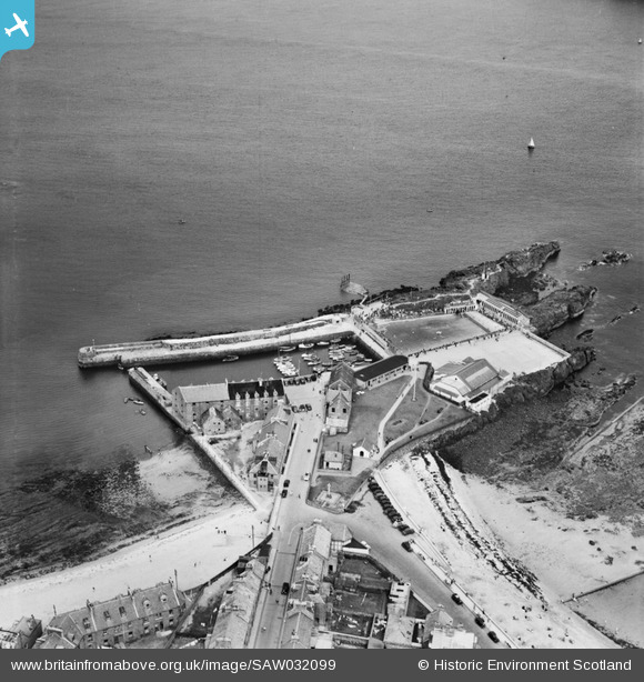
SAW032099 SCOTLAND (1950). North Berwick Harbour. An oblique aerial photograph taken facing north.
© Copyright OpenStreetMap contributors and licensed by the OpenStreetMap Foundation. 2025. Cartography is licensed as CC BY-SA.
Nearby Images (6)
Details
| Title | [SAW032099] North Berwick Harbour. An oblique aerial photograph taken facing north. |
| Reference | SAW032099 |
| Date | 1950 |
| Link | Canmore Collection item 1269679 |
| Place name | |
| Parish | NORTH BERWICK |
| District | EAST LOTHIAN |
| Country | SCOTLAND |
| Easting / Northing | 355350, 685650 |
| Longitude / Latitude | -2.717132784419, 56.061662605791 |
| National Grid Reference | NT554857 |
Pins
 MB |
Friday 21st of September 2012 10:58:13 AM |


![[SAW032099] North Berwick Harbour. An oblique aerial photograph taken facing north.](http://britainfromabove.org.uk/sites/all/libraries/aerofilms-images/public/100x100/SAW/032/SAW032099.jpg)
![[SPW027371] North Berwick Harbour. An oblique aerial photograph taken facing south. This image has been produced from a marked print.](http://britainfromabove.org.uk/sites/all/libraries/aerofilms-images/public/100x100/SPW/027/SPW027371.jpg)
![[SPW027367] North Berwick Bay. An oblique aerial photograph taken facing south-east. This image has been produced from a print.](http://britainfromabove.org.uk/sites/all/libraries/aerofilms-images/public/100x100/SPW/027/SPW027367.jpg)
![[SAW032132] North Berwick, general view, showing North Berwick Harbour and Law Road. An oblique aerial photograph taken facing south.](http://britainfromabove.org.uk/sites/all/libraries/aerofilms-images/public/100x100/SAW/032/SAW032132.jpg)
![[SAW032133] North Berwick, general view, showing North Berwick Harbour and North Berwick Law. An oblique aerial photograph taken facing south.](http://britainfromabove.org.uk/sites/all/libraries/aerofilms-images/public/100x100/SAW/032/SAW032133.jpg)
![[SPW027369] North Berwick, general view, showing North Berwick Harbour and Quality Street. An oblique aerial photograph taken facing north. This image has been produced from a print.](http://britainfromabove.org.uk/sites/all/libraries/aerofilms-images/public/100x100/SPW/027/SPW027369.jpg)