
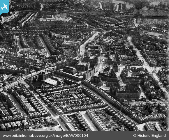
EAW000104 ENGLAND (1946). Kingswood Road and blocks of flats at Tilson Gardens and environs, Clapham Park, 1946
© Copyright OpenStreetMap contributors and licensed by the OpenStreetMap Foundation. 2024. Cartography is licensed as CC BY-SA.
Nearby Images (8)
EAW000104

EAW000105

EAW000103

EAW000099

EAW000101

EAW000102

EAW000100

EAW030128

Details
| Title | [EAW000104] Kingswood Road and blocks of flats at Tilson Gardens and environs, Clapham Park, 1946 |
| Reference | EAW000104 |
| Date | 4-April-1946 |
| Link | |
| Place name | CLAPHAM PARK |
| Parish | |
| District | |
| Country | ENGLAND |
| Easting / Northing | 530133, 173743 |
| Longitude / Latitude | -0.12713747337804, 51.447213193883 |
| National Grid Reference | TQ301737 |
Pins
 brianbeckett |
Thursday 18th of September 2014 11:28:55 AM | |
brianbeckett |
Thursday 18th of September 2014 11:28:12 AM |