
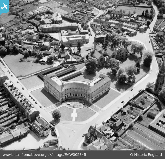
EAW005345 ENGLAND (1947). County Hall, the Shire Hall and the Police Station, Taunton, 1947
© Copyright OpenStreetMap contributors and licensed by the OpenStreetMap Foundation. 2024. Cartography is licensed as CC BY-SA.
Nearby Images (23)
EAW005345

EAW005344

EAW005139

EAW005138

EAW015038

EAW015039

EAW005140

EAW005137

EAW005135

EPW027891

EAW005136

EAW051942

EAW049104

EAW005141

EAW015037

EAW051946

EAW051945

EAW049103

EPW041182

EPW013545

EAW051947

EAW051943

EPW027886

Details
| Title | [EAW005345] County Hall, the Shire Hall and the Police Station, Taunton, 1947 |
| Reference | EAW005345 |
| Date | 13-May-1947 |
| Link | |
| Place name | TAUNTON |
| Parish | |
| District | |
| Country | ENGLAND |
| Easting / Northing | 322441, 124325 |
| Longitude / Latitude | -3.1057257927504, 51.012529542575 |
| National Grid Reference | ST224243 |
Pins
 Somerset Chick |
Saturday 18th of March 2017 11:03:59 PM | |
Somerset Chick |
Saturday 18th of March 2017 11:03:14 PM |