
Scheduled Maintenance
This website will undergo scheduled maintenance on Tuesday, September 10th, between 11:00 and 15:00, as well as on Thursday, September 12th, between 10:00 and 12:00. During this time, services may be temporarily disrupted. We apologise for any inconvenience.
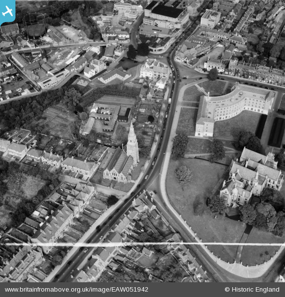
EAW051942 ENGLAND (1953). St John's Church, County Hall and Shire Hall, Taunton, 1953. This image was marked by Aerofilms Ltd for photo editing.
© Copyright OpenStreetMap contributors and licensed by the OpenStreetMap Foundation. 2024. Cartography is licensed as CC BY-SA.
Nearby Images (23)
EAW051942

EAW005136

EAW015037

EAW015039

EPW027891

EAW005140

EAW005139

EAW005344

EAW005345

EAW005135

EAW015038

EAW005137

EAW005138

EAW049104

EAW005141

EAW049103

EAW051946

EPW041182

EAW051945

EAW051948

EAW005340

EAW005342

EAW005337

Details
| Title | [EAW051942] St John's Church, County Hall and Shire Hall, Taunton, 1953. This image was marked by Aerofilms Ltd for photo editing. |
| Reference | EAW051942 |
| Date | 30-August-1953 |
| Link | |
| Place name | TAUNTON |
| Parish | |
| District | |
| Country | ENGLAND |
| Easting / Northing | 322371, 124392 |
| Longitude / Latitude | -3.1067378943323, 51.013122531394 |
| National Grid Reference | ST224244 |
Pins
 MG |
Saturday 18th of March 2017 09:19:46 PM |