
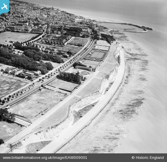
EAW009001 ENGLAND (1947). West Cliff, Royal Harbour and the town, Ramsgate, 1947
© Copyright OpenStreetMap contributors and licensed by the OpenStreetMap Foundation. 2024. Cartography is licensed as CC BY-SA.
Nearby Images (14)
EAW009001

EAW009026

EPW039347

EPW042860

EPW039355

EAW009027

EAW009000

EPW035448

EPW042858

EPW042863

EAW009019

EAW009022

EAW009018

EAW009020

Details
| Title | [EAW009001] West Cliff, Royal Harbour and the town, Ramsgate, 1947 |
| Reference | EAW009001 |
| Date | 12-August-1947 |
| Link | |
| Place name | RAMSGATE |
| Parish | RAMSGATE |
| District | |
| Country | ENGLAND |
| Easting / Northing | 637083, 164124 |
| Longitude / Latitude | 1.4033930496698, 51.326210460051 |
| National Grid Reference | TR371641 |
Pins
Be the first to add a comment to this image!