
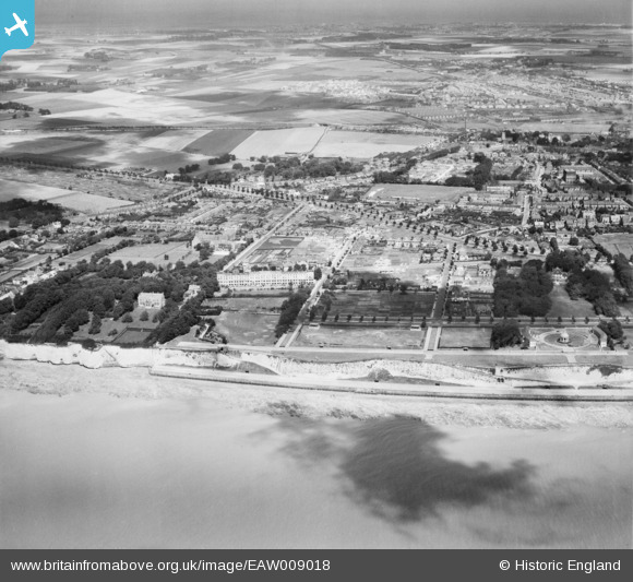
EAW009018 ENGLAND (1947). West Cliff and the residential area surrounding London Road, Ramsgate, from the south, 1947
© Copyright OpenStreetMap contributors and licensed by the OpenStreetMap Foundation. 2024. Cartography is licensed as CC BY-SA.
Nearby Images (13)
EAW009018

EAW009022

EPW035448

EPW042858

EAW009001

EAW009026

EAW009000

EPW039347

EAW009027

EPW042860

EPW039355

EPW042863

EAW009019

Details
| Title | [EAW009018] West Cliff and the residential area surrounding London Road, Ramsgate, from the south, 1947 |
| Reference | EAW009018 |
| Date | 12-August-1947 |
| Link | |
| Place name | RAMSGATE |
| Parish | RAMSGATE |
| District | |
| Country | ENGLAND |
| Easting / Northing | 636886, 164003 |
| Longitude / Latitude | 1.4004899822114, 51.325206326648 |
| National Grid Reference | TR369640 |
Pins
 Mike Floate |
Sunday 27th of April 2014 07:57:53 PM |