
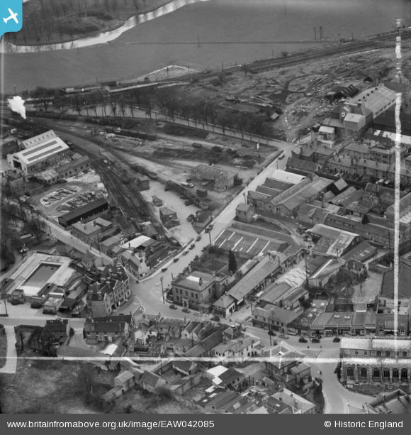
EAW042085 ENGLAND (1952). Wheelers Ltd Cornard Road Timber Yard and King Street Saw Mill, Sudbury, 1952. This image was marked by Aerofilms Ltd for photo editing.
© Copyright OpenStreetMap contributors and licensed by the OpenStreetMap Foundation. 2024. Cartography is licensed as CC BY-SA.
Nearby Images (19)
EAW042085

EAW042084

EAW042081

EAW042083

EAW042082

EAW042077

EAW042079

EPW001737

EAW042078

EAW042080

EAW042074

EPW025895

EAW042075

EPW025900

EAW042076

EPW025896

EPW001739

EAW029735

EAW029736

Details
| Title | [EAW042085] Wheelers Ltd Cornard Road Timber Yard and King Street Saw Mill, Sudbury, 1952. This image was marked by Aerofilms Ltd for photo editing. |
| Reference | EAW042085 |
| Date | 27-March-1952 |
| Link | |
| Place name | SUDBURY |
| Parish | SUDBURY |
| District | |
| Country | ENGLAND |
| Easting / Northing | 587552, 241199 |
| Longitude / Latitude | 0.73475086255248, 52.037002676045 |
| National Grid Reference | TL876412 |
Pins
 Matt Aldred edob.mattaldred.com |
Tuesday 7th of January 2020 01:54:34 PM |


